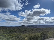
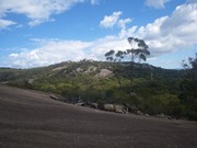
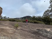
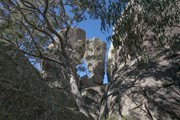
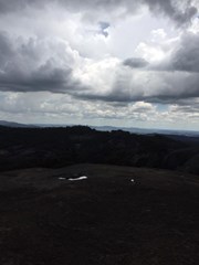
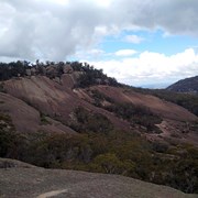
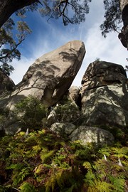
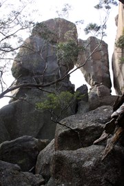
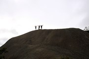
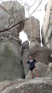
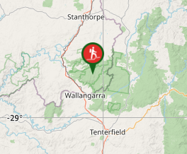
The highest point in Girraween - Mt Norman provides some great views of the park and also visits the Eye of the Needle.

Lookouts
Picnic Facilities
BBQ
Toilets
Scrambling or Climbing
No Dogs Permitted
Camping Permitted
Eucalypt Forest
1259m
Maximum Elevation
360m
Total Climb

Getting there:

Girraween NP is situated approximately 260km by road south-west of Brisbane. To reach the park, turn off the New England Highway 26km south of Stanthorpe or 30km north of Tenterfield onto Pyramids Road. The winding bitumen road continues a further 9km east through the Wyberba Valley to the park's Information Centre and day use picnic area.

An alternative road from Stanthorpe to Girraween via Eukey and Storm King Dam has some gravel sections.

Maps:

Girraween National Park

Route/Trail notes:

The track is well marked. Continue past the turn off to Castle Rock until the track emerges onto exposed granite. The track is marked with a series of white markers which head up the slab.

Keep an eye open for a T junction - the left track leads off to the Eye of the Needle, a formation of two balancing rock pillars.

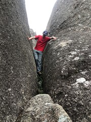
Eventually you'll reach a granite ledge. The final ascent to the summit requires technical rock climbing ability and should not be attempted without experience and a proper guide. Permission should also be sought from the park ranger.

Return via the same track, or alternatively follow white markers down the southern side of Mt Norman to the Mt Norman picnic area and arrange a car pickup from there. The picnic area is accessed via Wallangarra

Other References/Comments:

With so many bushwalking options in the park, why not take advantage of the excellent camping facilities at Castle Rock.

Comments

Good option if you want to be away from the crowds.

Wanderlust on 1 May, 2023

With Italian adventure-seeker Lucia :)

Eleasa on 14 Aug, 2022

Beautiful 360° views at the true summit of Mt Norman.
You will find it very difficult to climb up if you are:
Short
Wide hipped
Scared of heights
Not a confident rock climber
This is harder than Tibrogargan and Mt Beerwah.

Chesspeople on 20 Jun, 2022

Last little scramble up the crack to reach the summit is kinda tricky! But very great showcase of Girraween on this hike.

Amanda J on 28 Sep, 2021

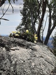
Left early to do this walk to avoid the heat later in the day. Very different from other times I have done this walk due to the loss of trees from fires and drought. That said, it was still an enjoyable walk. the wild flowers were everywhere, but not as profuse as previous years. The walk was capped off by finding a King Orchid on a rock in full bloom near the top of the mountain (see photo).

Brian on 9 Oct, 2020

Did through the opposite way! Much easier, just 5 kms from parking. Awesome climb

Breno on 5 Oct, 2020

Amazing geological features

gracilicaudatus on 4 Oct, 2020

Day trip to Girraween to complete some hikes with Danielle. Completed this one first, followed by Castle Rock then Sphinx and Turtle. Awesome geology and a great walk with some steep inclines. 17.8km in total with a stop for lunch at the top. Castle rock was my fave.

Sarah on 14 Aug, 2020

Windy at the top, but nice forest on the way. Well worth the effort.

Kaylene&Mal on 5 Aug, 2020

Great day for a walk ... Crisp winter air on a gorgeous sunny day. Quite a few people on the track as it was school holidays which was great to see.
Some parts challenged the legs but overall a pretty good walk.

Wattshappenin on 30 Jun, 2020

Nice full day walk with heaps to see along the way! Castle Rock was probably the highlight but Turtle Rock and the Sphinx are worth checking out. Went to Mt Norman and found the "track" to the summit. Overall the scrambling isn't too bad so long as you are relatively agile. There is one part where you are walking in a section of rock that is a bit like an inverted uphill triangle that is getting more and more narrow which is a bit hard going. If you climb to the side of it it's a bit easier. After you get past that part the rest of it is pretty straight forward. If you feel comfortable climbing Beerwah you can probably manage the summit of Mt Norman.

Vonsnrub on 6 Jun, 2020

There is a cairn on the top of the mountain though you need to do some climbing to the West. The actual summit requires you to jump across boulders and is not for faint hearted, especially on a windy day.

JayWalker on 11 Aug, 2019

Regrowth well under way post bushfires with many clearer sightlines to rocks along the way - a lot of them balancing (!) - but sadly the track to The Sphinx and Turtle Rock closed since them due to falling trees.

Bing Vandergraaf on 12 Jun, 2019

Wonderful hike i loved it. I tackled it from both directions from the my Norman day use area it’s 4km the ranger said this side has the steeper rock face to navigate but I found it to be quite doable. Sadly rain put a stop to my climb from the castle rock side. It has been very rainy so was quite wet and slippery and on decent it started to drizzle making it even more slippery.

Syd on 12 Oct, 2018

I did this walk on Thursday as well as the pyramid, Sphinx and Turtle Rock. I walked from the sign near the junction to the left, then the right as far as the granite slab several times and couldn't find the arrow marking the start of the rock scramble to the summit. This is the first time I haven't found a point that I was looking for, so could someone please tell me where it is so that I can do it next time. I have previously climbed Tibrogargan and Beerwah severel times and Mt Barney without any trouble. I even read through some articles while I was up there but no luck. Photos would be nice too if it is difficult to describe. Thanks heaps.
john

jgmansell on 2 Jun, 2018

Great place and very spiritual. Loved it.

Chris Park on 7 May, 2018

Some incredible things to discover on this walk. Great view from the top!

dalehikes on 27 Sep, 2017

There are several ways up, and I took the easier one - a mix of forest trails, rock formations, open rock plateaus, and a few sections of sloping rock face with drop offs that gave me the willies, because it was raining and slippery. in the dry it would have been no problem. The recommendation is that the climb at the peak only be attempted by people with experience.

Rey Leon on Sep, 2017

Thought there was a lop so when I got to the other end I had to go over Mt Norman again...no doubt I 've seen that mountain. Nice hike.

J on 15 Apr, 2017

We did a few of the walks together and when we finally got to the top of Mount Norman (just climbed - we're not rock climbers) and
oh crap - the thunderstorm starts!! Got down slowly and headed back.

HippyDonna on 31 Oct, 2016

Where

Click here to load this map.

Nearby Walks

Done this walk?

This walk has been ticked 96 times

Aussie Bushwalking can keep track of your bushwalks.

Login/signup to tick this walk off.

Tick walks to keep track of where you've been. You must Login to tick walks. Accounts are 100% free so sign up if you don't have one.