Menu
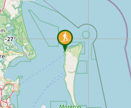
A long sand walk that starts at Bulwer in the North and finishes at reeders Point south of Kooringal. walking both on beach and inland trails.
Getting there
The only way onto the island is by Ferry. The Micat Service from Whyte Island or The Tangoolooma Flyer from Pinkenba. Since doing this walk the Kooringal trader has closed.
Maps
The Moreton Island Tourist map was adequate for this walk.
Route/Trail notes
I was able to do this walk using public transport all the way. I walked 50m from my house to catch a bus to the local railway station From Wynnum Railway station I took a taxi to Micat Ferries and caught the Ferry to Bulwer. This cost $35. Once I arrived at Bulwer I headed north to Comboyuro Point and Walked on North West Beach to Heath Island, crossing here was about a 100m wide wade in the lagoon. The crossing of Dog Creek was only ankle deep. The distance was about 9 km to North point. The walk continued along the beach past Yellow Patch around the hill of Honeymoon Bay to Cape Moreton Lighthouse and onto Cape Cliff following the rough path down to the Eastern Beach. This was about a 3km walk. The walk continued for 5 km down Eastern Beach to Blue Lagoon Campground which was pleasant for a nights camp and a cold shower after a swim in the surf and lake.
Next morning, I followed the lake shore around to Blue Lagoon Rd inland to the Telegraph Track turn off about 3 km. Following this track, that is an uphill slog with a few steep downhill sections.,for 8 Km to the Mt Tempest track, a bit over 2 km return.Well worth the effort for the spectacular views from the highest vegetated sand dune in the world. After the climb up and down the stairs I turned right onto Middle Road. and walked about 3km to the Tangalooma bypass Road to the beginning of the Rous Battery Track. This track is about 10km long and crosses the island in a south-easterly direction. On reaching The Rous Battery, a fort built for the protection of Brisbane during WW2. I followed south along the beach for about 2 km to the turn off to the Big Sandhills. This traverse of the island is only 1km wide but has interesting small iron sculptures in the sand. It is a steep and tiring ascent of this sandhill and steep descent on the western side. The second night camp was at the base of the Big Sandhill where there is a water pump. There is also a water pump at Rous Battery and Blue Lagoon.
The final day was a 2 km walk to the Small Sandhills and a traverse of the island at this point. A southerly walk of 6km or so, along the Beach to Reeders Point where the Kooringal trader use to ply it's trade. There were connections with straddie Buses, Straddie Flyer and the Cleveland Railway Station. Now adays a reverse of your walk along the western shore to The Wrecks seems to be only option unless you hire the taxi to move you.
Permits/Costs
Ferry Costs: Micat $35 one way $50 return.
Other References
Take a walk in South East Queensland has a number of day walk descriptions.
GPS Tracks
- No GPS available for this walk yet.


 55
55 3
3
Comments