


 kumotoriyama (GPX)
 23.2
23.2 10
10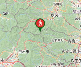
Aussie Bushwalking can keep track of your bushwalks.
Login/signup to tick this walk off.Mount Kumotoriyama 雲取山 (Chichibu-Tama-Kai National Park, Tokyo Prefecture)
Japan
Menu
GPS Tracks
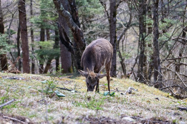
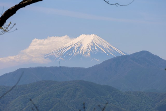
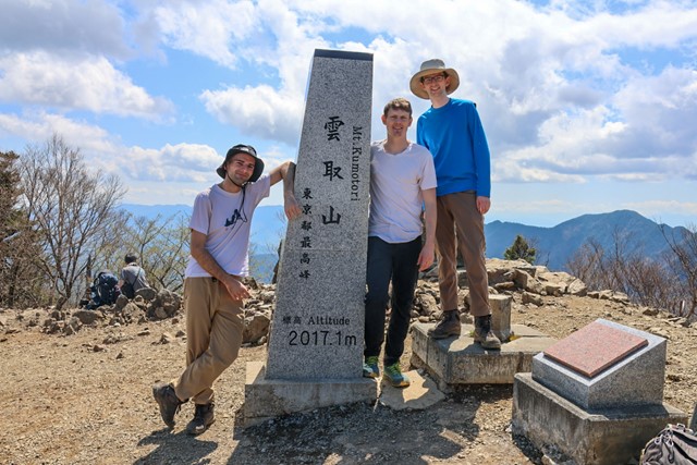

Mt. Kumotoriyama is the tallest mountain in Tokyo, standing at 2017 metres. Located in the heart of Chichibu-Tama-Kai National Par, it offers great views over Tokyo and out to Mt. Fuji. If you are lucky you might even see some wild deer and if you are unlucky some wild bears.
Mt. Kumotoriyama is one of the hundred famous mountains of Japan and gets busy on weekends.
It is possible to do as a long day hike or as a two day adventure. Whichever one tickles your fancy.
Lookouts
Alpine
2017m
Maximum Elevation
Getting there
You can either get to the trail head by driving or by taking the bus. There are other trail heads, but the easiest to access is the trail head in Okutama.
You can get to Okutama station from by catching the JR line from Tokyo Station. From Okutama station, you can catch a bus headed for either Kamosawa or for Tokura. Kamosawa is right in front of the trail head and is the most convenient, but these buses are infrequent. Tokura is just down the road and has more frequent buses. It's about a ten minute walk from Tokura to Kamosawa.
Once at Kamosawa which is technically in Yamanashi prefecture, not Tokyo, take the stair case and look for signs that read 雲取山.
If driving there are multiple paid and free carparks near and at Kamosawa. If parking a bit out, let's say near lake Okutama, you can take the bus to either Tokura or Kamosawa. But the carpark at Kamosawa should be free. I went during Golden Week and it wasn't a full house. Even though this is Tokyo, it aint' that busy or well-known.
Maps
Yamap
Route/Trail notes
Strap yourself in for a long hike if doing this as a day trip. Your legs are gonna feel it.
If doing this is a two day, make sure to book your mountain hut in advance which can be done via email online. There are two major mountian huts on Kumotoriyama with camping options available. Select what is best for you.
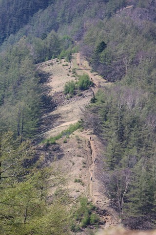
The trail begins with concrete. This is the least interesting part of the hike as it takes you through some bland forest up to a second carpark. From here the real hike begins. The concrete thins out and becomes proper ground. The incline isn't particularly steep, but its long. Trust me, it's hard yakka doing about 1400m of ascent.
Keep following the trail, looking out for signs that say 雲取山. Most forks in the road don't matter and either way will take you up to the summit. Just make sure you don't accidently take a side trail that leads to another mountain. If the fork isn't signed, then either way is fine. If it is marked and doesn't not have the characters 雲取山 on it, then you are going the wrong way.
Before reaching the summit of Kumotoriyama, you will reach Nanatsuishiyama, or the seven stone mountain. This is a good place for a rest that provides nice open views out to Mt. Fuji. It also some some benches for taking a rest.
From Nanatsuishiyama, you will be walking along a non-exposed ridge line that will take you to the peak of Kumotori. This is the best part of the hike, as it is quite wide and relatively open. If you are lucky you can see some deer feeding on the grass. Looks are decieving as it is still a long hike to the summit.
Once you reach the summit, go the same way back. If you are staying at the hut, the hut is located just after the summit and requires a bit more walking.
Note that there is nothing technical about this hike. It is just long and hard.
Mountain huts have toilets, food and drinks if you need them.
Permits/Costs
Nada. Just bring some wonga for the train.
Comments
Nobody has commented on this walk yet. If you've done it then tick it off and add a comment.