Known as one of the best day walks in ACT, Mt Gingera is the second highest mountain in the entire state after the nearby Mt Bimberi.
Getting there
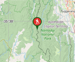
Set course for Corin Dam - once you arrive drive over the dam wall and you will find a small parking area right next to the start of the walk.
Route/Trail notes
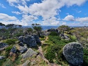
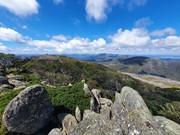
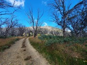
From the carpark you will walk past a toilet and will find 2 tracks - one going uphill on the left, one going downhill on the right. Unfortunately you will be taking the track on the left and you had better get used to uphill, because there is a lot of it in store for you. In fact during the first 2kms you will gain 600 meters of elevation! Rest assure after that first 2km it eases off quite dramatically. The track will eventually widen into a rough fire trail that will lead to a T intersection with another larger more defined fire trail. After turning left you will eventually pass Pryors Hut (an emergency hut in case of a whiteout). Not long after that the road will make a sharp turn to the left and start heading down hill - on this bend look out for a walking track on the right with a sign for Mt Gingera. Follow this track to the summit where you will find a bunch of large boulders and a nice view over the ACT high lands.
Permits/Costs
Nil Cost
Other References
https://www.alltrails.com/trail/australia/new-south-wales/mount-gingera-walking-track
GPS Tracks
- No GPS available for this walk yet.


 20
20 8
8
Comments