Aussie Bushwalking can keep track of your bushwalks.
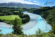
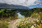
Login/signup to tick this walk off.The walkway follows the rim of the gorge providing views of the Rakaia River and Mt Hutt. Along the way there are a number of historical points of interest.
Getting there
The track starts off State Highway 72 Inland Scenic Route on the northern edge of the Rakaia River, upstream of the Rakaia Gorge Bridge, mid-Canterbury. It is 75 km from Christchurch 75kms and 11 km from Methven - 10 mins drive.
Park in the carpark above the boat ramp, then cross the road to find the start of the track (well sign posted)
Maps
Which maps cover the area?
Route/Trail notes
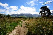
The walkway passes through several forest and shrub communities before climbing the gorse-lined historic ferryman's track. Continue along one of several glacial and river-carved terraces to a good lookout point (about 45 minutes)
The walkway follows the rim of the gorge through spectacular geological areas, showing lava flows of rhyolite, pitchstone and andesite. It then descends into a gully under a canopy of montane forest and shrub, to the site of the Snowdon coal mines. The entrances to several coal mine tunnels can be seen here, and the remains of equipment used for extraction.
The track then climbs out of the creek to a sign-posted junction. The walkway forms a loop from this point, with the right-hand track climbing across tussock-covered terraces directly to the lookout point. The track then passes through the bush to loop back to the junction. A side track off the loop descends to the river (boat landing track 121m).
Note: this walkway goes over private farmland; show your respect to landowners by keeping to the track, and not disturbing stock. Dogs or horses not permitted.
Permits/Costs
Nil
Other References
http://www.doc.govt.nz/parks-and-recreation/places-to-go/canterbury/places/mount-hutt-area/things-to-do/rakaia-gorge-walkway/
GPS Tracks
- No GPS available for this walk yet.




 10.4
10.4 3.5
3.5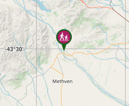
Comments