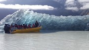
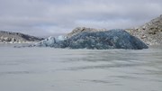
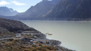
Icebergs can usually be seen floating in the lake in summer and in winter, the lake freezes over. The track leads through the old terminal moraines of the glacier to the lakeside boat ramp and you can see good examples of plant succession along the route. Tasman Lake is a relatively recent addition to the scene, starting its formation in 1974 and growing steadily since then. The large terminal moraines mark the foot of the Tasman Glacier at the time of the lake’s formation and are a sobering reminder of the glacier’s retreat.
Getting there:
From Mt Cook Village, travel back along Mt Cook Road and then turn left into Tasman Valley Road that takes you to the Blue Lakes car park (Tasman Glacier car park).
Maps:
Aoraki - Mt Cook Walking Tracks
Route/Trail notes:
From the car park, take the Blue Lakes Track up past the Shelter and after 200m take the right hand track. The optional left hand track (1km return), take you to a viewpoint on top of the moraine wall, with the Blue Lakes beyond, which offer good swimming in summer.
Continue on the right hand track, up and over the moraine, before bearing left and dropping down to the lakeside jetty. As the track bears left, an option 600m return track to the right will take you to the source of the Tasman River.
Return by the same route.
Permits/Costs:
None.
Other References/Comments:
As with most South Island towns, there are always numerous tracks in and around the area. In this case most notably are the Hooker Valley Track, Red Tarns and Kea Point.




 306 Tasman Lake (GPX)
 2.9
2.9 1
1
Comments