Menu
A short walk to a breathtaking view over Barrington Tops National Park.
Lookouts
Bird Watching
Picnic Facilities
BBQ
Toilets
Wheelchair Accessibility
No Dogs Permitted
Rainforest
Getting there
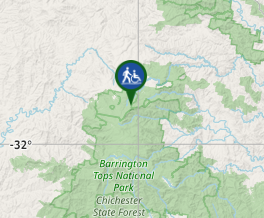
This walk is around the middle of the Barrington Forest Road between Scone and Gloucester on the southern side of the road.
Maps
Which maps cover the area?
Route/Trail notes
The walk begins at the Devil's Hole picnic area and takes you via a paved track to the lookout. Return via the same track.
Permits/Costs
No cost
Other References
How can I find more info? Any guide books?
GPS Tracks
- No GPS available for this walk yet.


 100
100 10
10
Comments