Menu
A walk through dry rainforest near Jerusalem Creek, in the southern part of Barrington Tops National Park.
Getting there
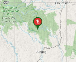
From Dungog take the Salisbury Road, and continue straight ahead instead of taking the Salisbury turnoff. Drive towards Chichester Dam. Turn right onto Wangat Trig Rd and follow it to the car park on the right hand side of the road or the day use area.
Maps
Which maps cover the area?
Route/Trail notes
This track begins at the Jerusalem Creek day use area and ends at another car park on the road in. Either use two cars, or return via the same track. The day use area is upstream from the car park at the other end, and there are quite a few steps and steep sections. There is a lookout over a waterfall 2 minutes in from the day use area end. On the other end, you cross 4 bridges over gullies.
Permits/Costs
No cost
Other References
How can I find more info? Any guide books?
GPS Tracks
- No GPS available for this walk yet.


 2
2 1
1
Comments