Sharpes Creek Track

Barrington Tops National Park

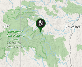
A walk through rainforest in the eastern section of Barrington Tops National Park from the Gloucester River Camping Area to the top of the hill and back via the road.

Bird Watching
Picnic Facilities
BBQ
Toilets
Rainforest

Getting there

Travel south from Gloucester and turn right into Gloucester Tops Rd.  This road is partly gravel and crosses a number of flood ways.  The road drives straight through the camp ground.  It's a fair way along,  it you can't miss it.  

Maps

Which maps cover the area?

Route/Trail notes

This track begins on the right, just before the Gloucester River Camping Area.  It takes you first through dry rain forest, and then ascends steeply through eucalypt forest up to the roadway.  Then turn left to return back to the start along the road.  This is a really steep walk.  You may prefer to  turn back once you reach the part of the track that begins the ascent.  There is a sign here that says that it's 30 minutes back to the camp ground.  This would make the total walk only 3km, and take an hour.  

Permits/Costs

NO cost unless Camping  

Other References

How can I find more info? Any guide books?

GPS Tracks

  • No GPS available for this walk yet.

Comments

We walked to the top of the hill but chose to walk back along the track rather than down the road making a 4 km walk. The ascent is really steep and exhausting. We did do it when temperatures in the surrounding areas were set to reach 42 degrees, so probably not the best day for it. Parts of the ascent are quite open, adding to the stress.

Ian and Sue on 29 Dec, 2016

Did this walk before I signed up on this website. Was on our way to Gloucester Falls circuit but it had closed unfortunately so parked up at the camping area further down. Found a notice board... Seemed a short easy walk on the vandalised map that was provided therefore failed to notice the inclines! Still very enjoyable. Saw many kookaburra along the way.

Samuel Armstrong on Dec, 2016

Where

Click here to load this map.

Nearby Walks

Done this walk?

This walk has been ticked 2 times

Aussie Bushwalking can keep track of your bushwalks.

Login/signup to tick this walk off.

Tick walks to keep track of where you've been. You must Login to tick walks. Accounts are 100% free so sign up if you don't have one.