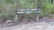
A circuit which consists of Shaws Ridge to the east and Springwood Ridge on the west. The trail descends into the valley which separates the two ridges through an area known as Blue Gum Swamp.
The Trail:
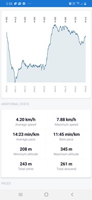
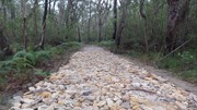
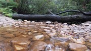
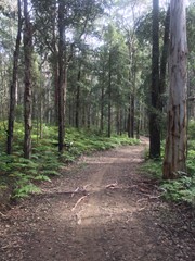
Take it anti-clockwise the first time. From the gate proceed down the trail and keep going straight ahead when you come to the sharp left fork. This will take you to a locked gate which you can walk around. The trail gradually climbs for about 4km to the top of ShawsRidge before a 1km steep descent into Blue Gum Swamp. The swamp is characterised by cool air, bird song and tall straight blue gums with a thick undergrowth of ferns. You'll follow the valley floor for around 4km. There are usually 3 small creeks to cross, which you can ride through or walk across without getting wet feet. These may be deeper after heavy rains.
About halfway along the valley you'll come to a right hand fork which leads up Bees Nest hill to Grose Head South. Bees Nest is a 1km steep climb and should only be attempted by advanced riders. The condition of the trail can vary greatly depending on the length of time since the last grading. From the top of Bees Nest it is a 900m walk to Grose Head South. Grose Head South features magnificent views of the Grose valley. If you take this detour please take care on the descent back down Bees Nest.
From the bottom of Bees Nest continue in an anti-clockwise direction to return to the starting point. You'll pass another locked gate and you'll feel the air warm as the valley widens and becomes less protected. Keep an eye out for the waratahs growing in the wild which flower during September/October. You can look, but don't touch.
Blue Gum Swamp finishes with a steep climb of around 800m back to the carpark.
Getting there:
Blue Gum Swamp is located at the end of White Cross Rd, Winmalee, NSW.
By car
- Depart the Great Western Highway at Springwood and follow Hawkesbury Road to Winmalee.
- 5km along Hawkesbury Road turn left into White Cross Road and proceed to the end.
By train
- Alight at Springwood Railway Station. Exit to the left and turn left through town, following Macquarie Road.
- Turn left at the 2nd roundabout into HawkesburyRoad.
- Follow this for 5km then turn left into White Cross Road.
The Blue Gum Swamp fire trail is at the end of White Cross Road. It can be accessed by foot or mountain bike only and is a circuit walk with a locked gate at each end. You'll be able to walk your bikes around the gates.
GPS Tracks
- No GPS available for this walk yet.




 10
10 2
2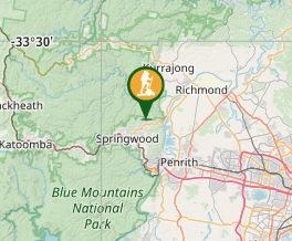
Comments