Menu
An off track walk to begin that tries to bag all 10 of Australia's Highest peaks.
Getting there
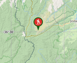
From Canberra follow the Monaro highway to Cooma from Cooma travel to Jindabyne and then follow the Alpine Way to Thredbo.
Maps
CMA map Kosciuosko
Youngal, Chimneys ridge
Route/Trail notes
This walk occured in mid February 2008, yet it still sleeted, snowed, stormed and basically tried to blow me away.
I parked at the carpark just down from Dead Horse gap and walked up the road to the actual dead horse gap Sign. On the uphill side of the road I followed an obvious foot trail up through the snow gums towards the Ramshead range and climbed South, Main and the North peak on this range. I camped the first night near the Cootapatamba hut on either the high part of Leather Barrell Creek or swampy plains River either way the water was cold.
The next Morning was to begin with a dip in Lake Cootapatamba. After this i walked to wards Mt Kosiusko. Approaching from the steep southern side. I found the graded path and walked to the summit of Australia, when it started thundering. I walked quickly down the path at Rawson's Pass where the highest toilets in Australia are situated. Climbed Ethridge's ridge behind the toilets and peak bagged my way to Seamans Hut. where I camped for the second night.
The next morning, I followed the 4wd drive track back up to Rawson's Pass, followed the path again to the Summit of Kosciousko, and then followed the Main Range walking track for about 2 km to the Branch off track to the Townsend trail which is about 3 km long to the summit of Australia's second highest peak. It is a rock climb to the top of this peak. after Townsend I headed off to the North Spur to Alice Rawson looking down onto Lake Albina and back to the south spur to Abbot Peak looking down onto Hannels Spur. I then followed the path back towards the main range graded path but left it to climb Muellers Peak. I then descended to the path and ticked off on the way Mt Northcote, Mt clarke, Mt Bell, Mt Lee and Carruthers Peak. Halfway down the path to Blue lake, follow the ridge line towrds Little Mt Twynam and then onto Mt Twynam. a storm brew ed up here stopping me from continuing onto Watson's Crag. I did make the Sentinels though.
It was a white out, freezing, sleeting, windy walk which blew me off my feet a number of times, back to Seamans Hut, where I made a huge fire in the Pot Bellied stove
The next morning I followed the path back tot the summit of Kosiusko where the wind picked up again. I followed the metal path and steps for 6 km to the Deadhorse Gap graded path and then followed this for 4 km to the carpark. it was steep but had anumber of nice lookouts and seat to rest upon.
Permits/Costs.
A permit was needed to enter the National Park $16.60 per day per car was the cost in summer in winter it was more expensive.
Other References
Snowy mountains Walks. Geehi bushwalking Club.
GPS Tracks
- No GPS available for this walk yet.


 37
37 4
4
Comments