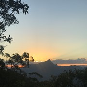
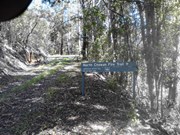
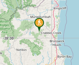
Reaching the top of Mt Chowan is a challenge, but a worthy challenge. Mt Chowan sits in the north-eastern corner of Mt Jerusalem National Park at a height of 523m. A fire trail and a track lead up along the side of the mountain until the final steep ascent.

Scrambling or Climbing
No Dogs Permitted
No Camping Permitted
Eucalypt Forest
523m
Maximum Elevation
368m
Total Climb

Getting there:

From Stokers Siding, turn into Smiths Creek Road that leads to Uki. Follow this road for 4km and as it curves to the right over the brow of a hill, the fire trail is to your left. The fire trail (North Chowan Road), is not signposted and is only market by a sign saying, 'rubbish dumping prohibited'. Travel along the track for 200m where you can park. The fire trail is gated from here.

Maps:

None found.

Route/Trail notes:

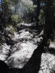
From the parking area, take the undulating track made by local mountain bikers to the left along the top of the range or the fire trail to the right.  The two tracks converge four times until the last one in a small grassy clearing denotes the end of the fire trail. Ignore the left fork on the fire trail; keep right.

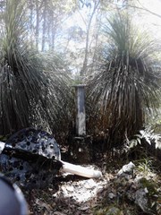
Now you just have the track straight ahead of you that ascents 100m in 400m to within 20m of the summit. The track goes around the eastern side of the mountain, before descending to the south. There is no path to the summit from the track; you just have to bush-bash your way up to the ordinance obelisk.

Take care, as because there are no views from the top, you can easily step off the wrong side from the top and miss the track. I would strongly recommend the use of pink flagging tape on your way up or rely on your GPS.

Return by either the track or the fire trail.

Permits/Costs:

None.

Other References/Comments:

If you want to see how to descend 400m from the mountain top in just 8 minutes, watch this u-tube video!

Mt Chowan Mountain Bike Video

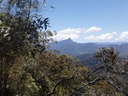
There are limited views along the track/trail, with only a couple of glimpses of Mt Warning to the north west. There is also no camping allowed.

Comments

Followed the GPS track in the description but found it a little misleading. I would probably opt to stay on the gradually ascending firetrail rather than take the steeply undulating track off to the left. The track doesn't offer any views the firetrail doesn't have (I would probably say the firetrail views are slightly better). The GPS track at one point directs you to enter a gate with a large NO TRESPASSING sign - which you don't encounter if you stay on the firetrail. And technically the GPS track doesn't actually go to the top of the mountain, had to find my own way for the last part (which was easy enough). The last little section to the summit has a faint footpad but would recommend keeping your bearings when you get the trig station on the top, so you don't walk back down the wrong side of the mountain. Otherwise pretty easy, no need for GPS.

Vonsnrub on 2 Nov, 2020

Great walk awesome views steep at the end didn’t see a soul took our time at the top and cruised back took 3.5 hours. Will do it again.

Mandy on 11 Jul, 2020

Nice long walk on fire trail , scenic in parts, steeper climb in the last bit to the top on a narrower trail, good views at the top .

Nes on 21 Jun, 2020

Gets steeper as you go

samkramer on 5 Mar, 2017

And there I was thinking: this is the last walk of the year, and low and behold I find a 'new' route! I thought that this was going to be an 'easy' climb; and it was at first. I then moved it to 'medium' and the final ascent to 'hard'. In 28° heat and my legs aching, I was glad to get back to the car!

F.A.B. on 18 Nov, 2015

Where

Click here to load this map.

Nearby Walks

Done this walk?

This walk has been ticked 10 times

Aussie Bushwalking can keep track of your bushwalks.

Login/signup to tick this walk off.

Tick walks to keep track of where you've been. You must Login to tick walks. Accounts are 100% free so sign up if you don't have one.