Aussie Bushwalking can keep track of your bushwalks.
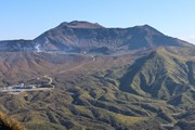
Login/signup to tick this walk off.One of the 100 famous mountains in Japan, Mt. Aso is truly epic. Being one of Japan's most active volcanoes, it is to be feared as it constantly plumes sulfuric gas that can be deadly. But thanks to its volcanic activity, Mt. Aso has scenery unlike anywhere else in Japan except maybe Mt. Kuju. Filled with lushious green fields, black volcanic deserts and boiling lakes. Mt. Aso is worth the trip.
Some would describe this hike as A.S.O too much volcano or even danger volcano.
Getting there
The hike begins at Mt. Aso museum carpark. You can either drive up here or take a bus, either is fine. Just be careful of bus time tables and do your best to get to the carpark as early as possible as the mountain becomes very crowded and it is impossible to drive up the mountain due to the gridlock. Be warned that buses may also be late due to the insane traffic.
If wanting to visit the Nakadake crater, travel to the next carpark up the mountain, but be warned that restrictions are in place and you may not be able to visit the crater due to sulfric gas emissions.
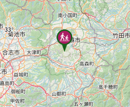
Maps
Git gud and learn how to travel using the stars
Route/Trail notes
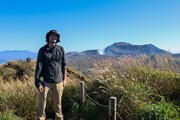
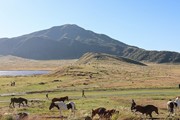
To get to Mt. Eboushi, it is a bit tricky as there is no signage. From the carpark, you will see a horse ranch and if you are lucky a lake. You will want to walk past the lake and towards a gap in the mountains. Mt. Eboushi is the tall mountain that you can see from the carpark, not the small boi that you can see directly in front of you. Continuing following a horse trail through the grass and you will reach the true starting point. There will be a gate that is signed with Mt. Eboushi. Undo the rope and make sure to tie it back up behind you, this is to stop horses coming in. The trail then goes upwards and there is only one route that is obvious. At the summit you can take the other route down to the carpark from the summit.
Once back at the carpark, look for a concrete trail behind the rest stop with all the resturants. Here follow signs for Mt. Kishima. It is a concerete path with a lot of steps. It is obvious but a bit tough because of the gradient of the steps. Once at the peak, you can walk around the crater of the now extinct volcano. Once looped back to the summit, you can follow signs down to the carpark and hope that the path to the Nakadake crater is open. Make sure to check it is all g before attempting to go to the crater as you will be turned away if there are sulfuric gas emissions.
Permits/Costs
Parking is 500 yen and parking at the crater is 1000 yen.
GPS Tracks
- No GPS available for this walk yet.


 6.1
6.1 3
3
Comments
Nobody has commented on this walk yet. If you've done it then tick it off and add a comment.