Aussie Bushwalking can keep track of your bushwalks.
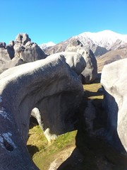
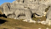
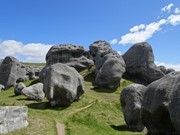
Login/signup to tick this walk off.Castle Hill Basin lies between the Torlesse and Craigieburn mountain ranges and is characterised by its distinctive limestone rock formations. These limestone rock formations are the water eroded remnants of limestone formed during the Oligocene age 30-40 million years ago when much of present day New Zealand was covered by the sea.
The area is of special cultural, spiritual and historical significance to Ngai Tahu who named it Kura Tawhiti (treasure from afar). Hidden amongst the limestone outcrops of Castle Hill are traces of 500-year old charcoal drawings traditionally said to have been left by the Waitaha, the first people to travel through this area.
Getting there:
Castle Hill is on the State Highway 73 about 94km (1hr 15m) from Christchurch, just before Arthurs Pass, as you head to the West Coast. The car park is right next to the main road.
Maps:
None found.
Route/Trail notes:
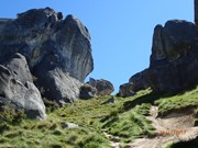
From the Castle Hill car park, you walk down a dusty track (600m), headed towards (and flanked by) hills full of rocks. Once at the end of the track, the path starts to climb up the hill, with various tracks diverging off this, as there is no real route. You make your way up and around and explore the area as extensively as you like. You’ll pass by heaps of huge rocks and you’ll also see some awesome views over the surrounding countryside. A section to the right, know as Lance McCaskill Nature Reserve cannot be accessed without a permit.
Permits/Costs:
None.
Other References:
For more information visit link Castle Hill
In 1998 the Kura Tawhiti Conservation Area was designated as Topuni to ensure that the values Ngai Tahu place on this area are recognised, acknowledged and respected.
Cave Stream Scenic Reserve, 12km further on towards Arthurs Pass is just one of many walks in the area worth doing.




 293 Castle Hill (GPX)
 5
5 2
2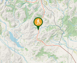
Comments