


 6.1
6.1 2
2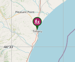
Aussie Bushwalking can keep track of your bushwalks.
Login/signup to tick this walk off.Hectors Coastal Track
South Island NZ
Menu
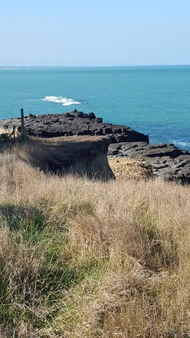

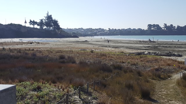
Hector's Coastal Track offers coastal scenic views, as it crosses Caroline Bay, up to the old Lighthouse and along the cliffs to Dashing Point and beyond.
Swimming
Picnic Facilities
BBQ
Toilets
Dogs Permitted
Coastal
24m
Maximum Elevation
24m
Total Climb
Getting there:
Whilst in Timaru, head to Caroline Bay and turn onto Port Loop Road from Theodosia Street. Car parking is available in the middle of the loop.
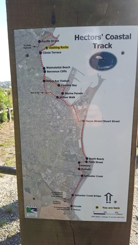
Maps:
Route/Trail notes:
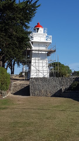
From the car park, you can walk north through the parkland to the rail bridge viaduct, where the pathway continues to the right of the rail line out to the lighthouse.
Alternatively, walk out onto the beach and along to the lighthouse.
From here, the pathway follows the shore line to the end of Richmond Street. Walk up and take the first right into Climie Terrace, where you join the pathway again that follows the cliff edge out to Dashing Point, where it crosses the small bay and then heads left to Pacific Street.
Return by the same route, or at the end of Pacific Street, head back towards town on Westcott Street and back down Richmond Street to rejoin the pathway.
Permits/Costs:
None.
Other References/Comments:
As with most South Island towns, there are always numerous tracks in and around the area. In this case most notably are Jack's Point Walkway, Centennial Park and Otipua Wetlands.
GPS Tracks
- No GPS available for this walk yet.
Comments