


 14.3
14.3 10
10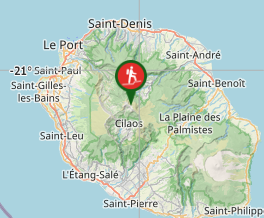
Aussie Bushwalking can keep track of your bushwalks.
Login/signup to tick this walk off.Piton des Neiges
Overseas
Menu

A long steep hike up to the roof of the Indian Ocean - the summit of Piton des Neiges on Reunion Island near Madagascar. At just over 10,000ft this volcano towers over the tiny island.
Lookouts
Bird Watching
Picnic Facilities
Toilets
Camping Permitted
Coastal
Rainforest
Alpine
3069m
Maximum Elevation
Getting there
Set your GPS to - Parking du Bloc Reunion Island - There is a medium sized carpark that fills up at the peak times of the day. It is free to leave your vehicle there overnight.
Route/Trail notes
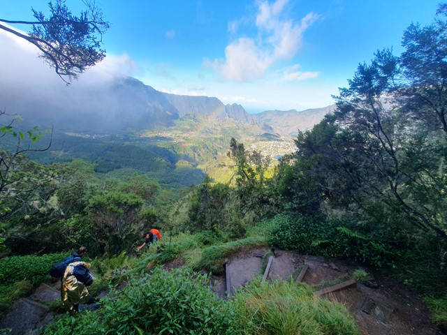
The walk is well marked and well maintained and starts from the carpark. The first hour is the steepest section with lots of stairs and switchbacks. Even though it eases off a bit an hour in it is still constant uphill all the way to the refuge. The refuge is a large hut with a common area, bathroom with flushing toilets, a dining room and 2 sleeping areas filled with bunk beds. Blankets are included but you will have to bring your own sleeping bag liner or sheets. You can also purchase drinking water, beers and snacks here. The staff are all very friendly but only speak limited English.
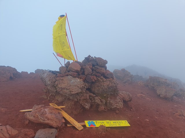
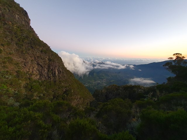
The walk from the refuge to the summit follows a rocky trail that is a bit more undulating than the constantly steep uphill you faced to get to the refuge. Eventually you will pass rock barriers built to shelter people from the cold wind at the summit and from here it is only a short walk to the summit. On a clear day you will be greeted by immense views of the island and the nearby ocean.
Permits/Costs
If you elect to stay at the refuge it costs 19 Euro for the night + 32 Euro if you elect to have dinner and breakfast included.
https://book.reunion.fr/fr/hebergements/a310792/product/reserver
Other References
https://www.alltrails.com/trail/reunion/saint-pierre/piton-des-neiges
GPS Tracks
- No GPS available for this walk yet.
Comments