Aussie Bushwalking can keep track of your bushwalks.
Login/signup to tick this walk off.A short distance from Seoul, Baegundae is a great escape from the city. The national park offers hiking tracks for all levels. Anything from easy to rock scrambling. Baegundae is somewhere in-between. The national park is accessible by public transport and is quite popular. To avoid crowds, it is best to go as early as possible.
Getting there
To get to the Bukhansanseong Fortress Course using Seoul public transportation, take the metro to Gupabal Station (Line 3). Outside Exit 1, hop onto bus 704 to Bukhansanseong Fortress. Get off at the Bukhansanseong Hiking Support Center to enter Bukhansan National Park and follow the signposts to your preferred route.
If unsure which bus to get onto or which bus stop to get off at, I can guarantee there will be other people who are evidently dressed like they are ready to go hiking. Just follow these people and you will end up at your destination.
Maps
The concept of google maps doesn't exist in South Korea. Naver nor Kakao maps are not much better. For this, it is best to rely on your own wit and whatever signs that you can find in the park.
Route/Trail notes
The hike is well signed in both Korean and English, it is difficult to get lost.
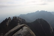
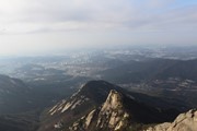
The first part of the hike is relatively easy, it takes you up a gentle incline. Even from early on, the various sheer cliff faces should be visible.
Along the way there are benches of various sorts to sit down on as well as some historically significant structures.
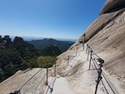
Towards the top, the incline steepens. The final stretch is very narrow and an almost verticle climb. There are chains to help pull yourself up over the exposed rock; however, due to the sheer amount of people doing the hike, coming down and going up, this section of the hike gets bottle necked. Be patient.
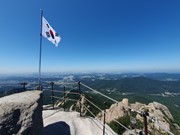
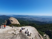
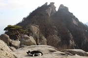
The peak has a very small platform for which to stand to on. There is a better place to sit just below the true peak.
GPS Tracks
- No GPS available for this walk yet.



 8
8 5
5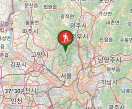
Comments