


 13.7
13.7 10
10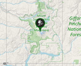
Aussie Bushwalking can keep track of your bushwalks.
Login/signup to tick this walk off.Mt St Helens
United States of America
Menu


A long and progressively steep day walk up the smoldering husk of what remains of Mt St Helens after the 1980 eruption.
Lookouts
Bird Watching
Scrambling or Climbing
Rainforest
Arid or Desert
Alpine
2549m
Maximum Elevation
Getting there
Set your GPS to the Climbers Bivuoac Trailhead. Here you will find ample parking - however the distance from where you park to the trail head will be determined by how early you arrive.
Route/Trail notes
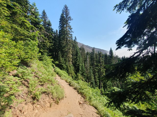
The walk starts off easy enough - along a well marked undulating forest path that gently ascends to the boulder field. The boulder field is when the gradient changes drastically and you will begin your ascent. The path has tall markers guiding the way which should prevent you going off-course. As you get higher the boulders get larger and eventually you will required to do some basic scrambling to get to the beginning of the scree field. The scree field is the steepest section of the walk and involves walking up a steep slope on loose volcanic rocks. It is quite easy to lose your footing on this stretch and hiking poles can come in very handy. Reaching the rim of the crater you will turn left and have around a 20-30min walk to the summit. This part involves steep ascents and descents and walking over small sections of ice - be cautious not to walk too close to the edge of the rim when walking on ice - people have died when the ice has given away leading to a long fall into the crater. There are great photo opportunities from the start of the boulder field all the way to the summit, but the best photos are from the rim. Return via the same path.
Permits/Costs
Between April the 1st and October the 31st you will need to purchase a permit which is $20 USD. These go on sale at midnight on the 1st of the preceeding month. For example - If you want a permit for the 15th of July, you will need to purchase the permit at 0000 (Washington time) on June 1st. There are only 110 permits issued per day so you either need to get in early, or wait for someone else to cancel.
Other References
GPS Tracks
- No GPS available for this walk yet.
Comments