Aussie Bushwalking can keep track of your bushwalks.
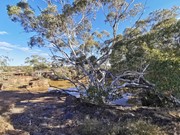
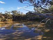
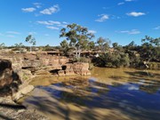
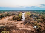
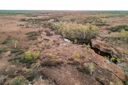
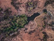
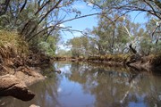
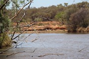
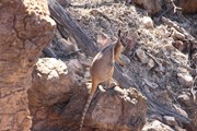
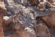
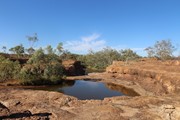
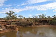
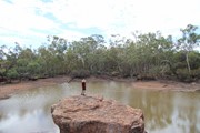
Login/signup to tick this walk off.Hell Hole Gorge National Park is a wonderful spot about an hour drive from the small township of Adavale. Adavale has a pub/general store, but no fuel. During the hotter times of year it is recommended that you stop into the store or police station in Adavale before heading to Hell Hole Gorge, and let them know of your plans. I strongly recommend a 4WD, there are creek crossings that can be subject to washouts. Once on Hell Hole Gorge National Park there are 2 good swimming holes, Hell Hole Gorge and Spencer's Gorge. Both are lovely, but I personally prefer Spencer's Gorge. The walks up the creeks and from both points are incredible, but there are no marked walking tracks. The park is one of the few places the lucky bush-walker might see the elusive Yellow-footed Rock-wallaby. Though don't worry if you don't, there is a captive population at the National Parks Office in Charleville. The best time of year to be at the park would be late Autumn to early Spring. After rains both locations have lovely cascades and waterfalls. The majority of the park is inaccessible to the public, walking from both gorges is a worthwhile experience.
Getting there: 4WD access only, about 1 hour north-west of Adavale.
How do you get to the start of the walk? Both Spencer's Gorge and Hell Hole Gorge are at the end of loosely marked tracks. Once entering Hell Hole Gorge National Park, follow the instructions on the sign board at the entry. Spencers Gorge will be the first marked turn to the right that is encountered, is you keep going without turning you will come to the Powell Creek crossing, this should definitely only be attempted in a 4WD. To cross the creek, enter the water way at the marked location (Blue cats eye reflectors) and follow the creek bed South-east for about 100m before turning around and following the creekbed back North-west on the other side. During dry times this route is easily visible, if the creek is flowing a depth-scout should walk the creek ahead of the vehicle. The path is marked using (blue reflectors glued to the rock, these can be hard to see). There is also signs in trees indicating the correct crossing points. Once on the other side of Powell Creek, follow the road for a further 500m. Hellhole gorge is visible from the road.
Maps
Which maps cover the area?
Google maps.
National Parks.
https://www.npsr.qld.gov.au/parks/hell-hole-gorge/pdf/hell-hole-gorge-np-map.pdf
Route/Trail notes
There are no marked trails, though short walks up the creeks are easy to see and follow.
Permits/Costs
Do you need any permits? What's the cost? There are no permits or costs. Camping at Hell Hole Gorge National Park can be booked via the National Parks website.
Other References
How can I find more info? Any guide books? The National Parks Office in Charleville can provide information about the park. Or https://www.npsr.qld.gov.au/parks/hell-hole-gorge/ will provide an overview.
GPS Tracks
- No GPS available for this walk yet.



 2
2 3
3
Comments