Aussie Bushwalking can keep track of your bushwalks.
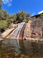
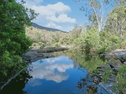
Login/signup to tick this walk off.A longish walk (17 kilometres return) with a spectacular destination at the base of Alligator Creek Falls. The walk commences at the Picnic and Camping area, and is mostly gentle in grade, traversing up the Alligator Creek Valley through grassy open tropical woodlands, riparian forest and patches of rainforest. The walk involves 4 creek crossings, one at Cockatoo Creek, and 3 crossings of Alligator Creek itself. You will need to ford or boulder-hop at these crossings, depending on the water levels. Usually it is an easy boulder-hop, except for after flooding in the wet season. There are a couple sections in the middle of the walk which follow a power-line easement and access road. These sections can be hot and exposed in the middle of the day. This walk is best suited to the cooler months. Swimming is possible at the base of the Falls year round.
The 4 kilometre return walk to Cockatoo Creek provides a pleasant shorter option.
Getting there
How do you get to the start of the walk?
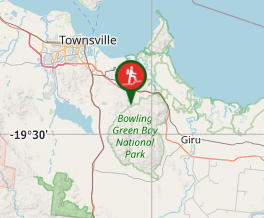
Turn off the Bruce Highway at Alligator Creek and follow the road for about 6 kms, ending at the Bowling Green Bay National Park Camping and Picnic Area.
Maps
Which maps cover the area?
Route/Trail notes
A detailed description of the walk!
Permits/Costs
Do you need any permits? What's the cost?
Free
Other References
How can I find more info? Any guide books?
GPS Tracks
- No GPS available for this walk yet.


 17
17 5.5
5.5
Comments