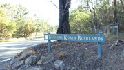
- Brisbane Koala Bushlands (Stockyard Creek Walking Trail) (Brisbane City Council Local Walks)
- Summit Street Reserve (Brisbane City Council Local Walks)
- Spotted Gum Trail (Daisy Hill Conservation Park)
- Tree Discovery Trail (Daisy Hill Conservation Park)
- Buhot Creek Circuit (Daisy Hill Conservation Park)
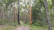
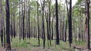
A pleasant walk in bushland that takes about 1 hour. You are likely to have the walk to yourself and see wallabies and various bird species.
Getting there
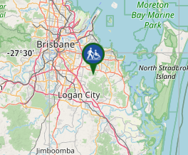
There is no public transport. The walk starts at the end of Longton Court, Burbank where there is plenty of parking.
Maps
There is a not-very-useful Brisbane City Council map at https://www.brisbane.qld.gov.au/sites/default/files/20160926-brisbane_koala_bushlands-map.pdf - these trail notes are so detailed that you won't need a map.
Route/Trail notes
Intersections on this trail are marked by posts with numbers on them. Times given in these notes are cumulative and based on a walking pace of about 4 kph.
From the end of Longton Court, pass through the gates and follow the wide horse trail straight ahead.
After 3 minutes – you will see post number 25. Continue straight ahead.
5 minutes – you get to a Bushfire Water Tank. Continue straight ahead keeping the tank on your left.
8 minutes – post number 30. Take the left fork. If you look carefully you are likely to see wallabies in this area, often well hidden in the grass. The trail descends past a small dam, across a creek bed and up the other side.
16 minutes – post number 84. Turn right.
23 minutes – post number 75. Ignore the trail straight on and turn left to go down onto another trail. This drops down towards Buhot Creek and then follows above it - there is a range of birdlife in this area.
40 minutes – post number 85. Turn right here and ignore the horse trail on the right 1 minute later.
42 minutes – post number 29. There is another small dam on the left. Continue straight ahead across the creek bed and around to the left above the dam..
47 minutes – post number 28. Take the left fork.
48 minutes – you get back to the Bushfire Water Tank you passed near the start. Turn right.
53 minutes – you should be back at your car.
Permits/Costs
None
GPS Tracks
- No GPS available for this walk yet.
Where




 3.5
3.5 1
1
Comments