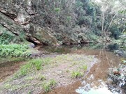
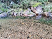
A short circular stroll following and crossing Neurum Creek.
Getting there:
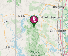
From the Bruce Highway, take the D'Aguilar Highway (R85) at Caboolture. At Wamuran turn left onto Campbells Pocket Road and then left onto Mount Mee Road before turning right into Sellin Road, signposted to The Gantry and D'Aguilar National Park. Just past The Gantry day use area, take the first turning on the right: Neurum Creek Road (4WD recommended) and after 6km turn right into Neurum Creek camp ground.
Maps:
Mount Mee Forest Trail and Drive Map
Route/Trail notes:
From the far end of Neurum Creek camp ground, walk down and across the creek's stepping stones and up the track on the far side. Follow the track along the creek and then across the bridge on a circuit that brings you back to the bridge and from there retrace your steps back to the camp.
Permits/Costs:
None.
Other References:
D’Aguilar National Park Locality Map
This is just one of five walk that can be taken in this section of D'Aguilar National Park.


 121 Lophostemon Walk (GPX)
 1
1 30
30
Comments