Illinbah Circuit

Lamington National Park

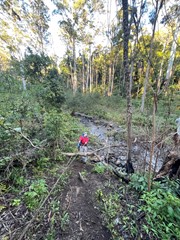
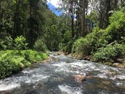
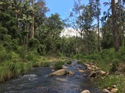
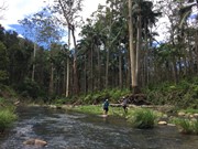
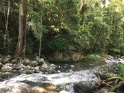
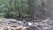
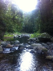
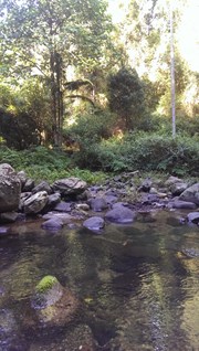
This track explores the lower reaches of the Coomera River. And there are many river crossings. The track may change slightly after heavy rains.

Swimming
Picnic Facilities
No BBQ
Toilets
No Wheelchair Accessibility
No 4WD Required
No Dogs Permitted
No Cycling Permitted
No Trail Bikes Permitted
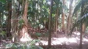
Rainforest
650m
Maximum Elevation

Getting there

From Nerang follow signs to Binna Burra. Approx 1km before the Binna Burra Lodge is the Rangers Station and Information Centre.

Maps

Beechmont , Great Walk

Route/Trail notes

Begin by following the track for the Gwongoorool Pool Track. Until you come to the Illinbah junction turn here and begin an 8km decent to the Illinbah Campground.

Permits/Costs

If you intend to camp at the Illinbah clearing a camping permit will be required.

Other References


Comments

Hike with Sarah and Geordie.
Anti-clockwise walking direction is correct!!
Got feet wet with all the creek crossings and overheard a men's group talking about embracing Death.... Most fun.
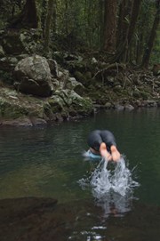
Good dip in Gwongoorool Rock Pools too

RockyRoger on 14 Apr, 2024

No heavy rain in a while so conditions ideal. A fairly difficult hike, but if you have moderately good balance and fitness you should be able to complete it (some in our group were inexperienced hikers). We all kept our feet dry there and back, and managed to avoid any particularly nasty stinging plants.

Approx. 5hrs in including a lengthy stop at the pool, but we got out in just over 3hrs. Take the time to visit the pool, it's well worth the extra 1.6km!

jgrun14 on 29 Sep, 2023

We hiked the wet side of the circuit to the campsite (there and back) as the dry side remains closed.
There are 14 creek crossings and none are easy - we didn’t hike after recent rains but couldn’t find steady footing/established rocks to hop over. We got wet feet after we kept sliding/falling in. Lots of slippery rocks on crossings.
Sections are very overgrown and you may need to dodge a few Gympie Gympies growing next to the trail. A few creek banks are quite high and slippery and you’ll need to use their ropes to pull yourself up/rappel down. Campsite (about 9-9.5km in) was beautiful but we won’t hike this again. Trying not to fall in the creek with a pack on isn’t my idea of fun.

mjorn_ on 26 Jun, 2023

Finally got round to this one after its long closure due to storm damage then fire damage. A walk with something different to offer than other Lamington National Park walks when at the bottom of the valley there are times where you aren't able to see the Darlington Range and Beechmont Range rising on either side of you. While more water does increase the difficulty of the river crossings it more than makes up for it due to the beauty it adds as well as the refreshing coolness on gympie gympie stings which can be difficult to avoid in the at times overgrown trail.

Lahs on 3 Jan, 2022

Nice Walk. Some huge figs, nice palm groves & lots of hillside gums. Creek crossings in Oct fairly easy with dry feet but would get trickier after a bit of rain. No leeches in Oct but got home with a few ticks attached. The trail back up from Gwongoorool Pool (if doing it counter-clockwise) climbs approx 300m over 3km - not too bad depending on your pack weight. Clockwise would give a much slower ascent from the bottom. Decent flat campsite opposite side of the creek from the "official" NPS signed camp.

pdm on 15 Oct, 2016

This was my first overnight walk carrying all my own gear - loved every minute!

We set out on Friday afternoon and hit the trail in an anti-clockwise direction. It is a nice steady descent passing through a variety of vegetation from rainforest to eucalypt forest back into semi rain forest. We reached the camp site in about 3 hours. The camp site is not marked but pretty obvious - if you get to the creek you've gone too far. Distance as per Map My Walk - 10.4 km.

Day 2 we set out just after 7. Not knowing what was ahead of us, we did the creek crossing in thongs thinking we would rock hop the rest of the 13 crossings and keep our feet dry - ha!! Don't bother, just step on into the creek as there is No WAY you can do this circuit and keep your feet dry - unless you bring your waders!

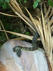
This second half of the trail is marked with Red triangle markers on trees, and you need to keep an eye out for them as sometimes the trail is not very clear. The first couple of crossings are a little challenging but ok if you take your time - walking poles make them much easier. Keep an eye on your legs for leeches - there are lots of them. Also keep an eye out for snakes, we saw 2 pythons.

It took us 4 hours 40 minutes to complete the track, that included a couple of stops and a detour down to the Gwongooral Rock Pools. Distance 15.6 km (1.2 km return to the rock pools) as per Map My Walk - bringing the total distance for the circuit to 24.8 km. i can't explain the huge variance in the distance quoted for this walk (about 17km) - we did not deviate from the trail (except as noted) and the gps map corresponds to the Topo map. I would love to hear from anyone who can explain.

Overall a fantastic walk for our first overnighter.

Deb on 13 Feb, 2016

Great walk but so ready for a rest when we got back. Had a little trouble following the track in some places but not a problem really. We tried to keep our feet dry but ended up getting them wet. In the end got tired of taking off our shoes when we couldn't rock hop across and just crossed over through the water with shoes on. All in all a really great walk to be recommended but be prepared to get your feet wet and take plenty of water. It took us 7 hours in a clockwise direction including the side track to the pool.

Ian and Sue on 12 Jan, 2016

A fun hike with plenty of creek crossings. I would suggest going clockwise, as we went the opposite and spent the last 3km going up hill which is pretty tiring after trekking 14km.
The track could be difficult to spot in some places where it was overgrown and there were no markers but a lot of it is marked and we only spent maybe an extra hour finding our way back to the path or navigating creek crossings.
All up it took 8 hours with maybe 30-40 minutes of that resting.
We came across two leeches and a small snake during the walk and another couple we passed said they saw two red belly black snakes but we all survived.
All in all a great hike albeit more epic than expected :)

jadetron on 30 Dec, 2015

Did it in conjunction with Gwongoorool. Took about 4 hrs. Ended up with a few ticks

callo on 2 Nov, 2015

Awesome walk one of my favorite at Binna Burra. Lots of river crossings so be prepared to get your feet wet!

Matt on 1 Aug, 2015

This was a great hike today it took 5hrs and nobody said there was 15 creek crossings but the views were well worth the journey.

Dizzygill on 16 Jul, 2015

This was a great hike today it took 5hrs and nobody said there was 15 creek crossings but the views were well worth the journey.

Dizzygill on 16 Jul, 2015

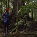
I loved this walk, it might be one of my favourites in Binna Burra. Half of the walk is very rainforesty: a whole lot of absolutely beautiful creek crossings and you're following orange arrows along the trail. The arrows are quite easy to follow, but there were a couple of times I had to do some circling around the area to spot the arrow marking the trail. Also note that at the moment, at one of the creek crossings there's some lantana that's covered the arrow on the tree trunk on the other side. The trail isn't too hard to spot, and you just have to look carefully for the arrow amongst the lantana. I have no off-trail experience and this was my first time relying on markers and I managed fine. This rainforesty half of the walk also plays host to a GIANT strangler fig that's incredible to see, and there were three lyrebirds on the track too. Be wary of stinging tree leaves!

The second half of the walk (in a clockwise direction) is just 8km of winding around the side of mountains on a very well-defined track in typical bushland. This felt like a bit of a slog after how fantastic the first half was, so I'd recommend doing this walk anticlockwise so you get to finish with the more fun part!

The circuit takes you right back to where you started (it was nice to not have to walk down the road at all!). Definitely recommended.

Anonymous on 10 Jul, 2015

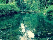
I jumped in the pool, it was soooo cold still, but awesome :)

Zara13 on Sep, 2014

Fantastic walk, fun creek crossings and a beautiful water hole. beautiful trees & bush.

liteseer on 31 Aug, 2014

Binna Burra again. A few too many creek crossings, be careful after rain.

Homely Beast on Sep, 2012

A great walk but be prepared to get your feet wet! A lot of crossings of the Coomera River.

Laurence Hallam on 17 Jun, 2010

Lots of leeches, I mean lots!!

Curt Lee on 2007

Where

Click here to load this map.

Nearby Walks

Done this walk?

This walk has been ticked 38 times

Aussie Bushwalking can keep track of your bushwalks.

Login/signup to tick this walk off.

Tick walks to keep track of where you've been. You must Login to tick walks. Accounts are 100% free so sign up if you don't have one.