IMPORTANT: The route to Mount Ernest from Yellow Pinch via the northeast ridge involve traversing private property. You should contact NPRSR to obtain contact details for the landowner in order to obtain permission to enter private property.

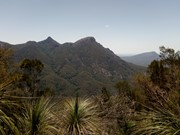
Mount Ernest lies on the opposite (northern) side of Mount Lindesay Highway from its namesake, and provides spectacular views of Mount Barney to the north. While much lower than the main peaks of Mount Barney, routes to the summit of Mount Ernest are less trodden take just as long.

Scrambling or Climbing
Navigation Required
964m
Maximum Elevation
750m
Total Climb

Getting there

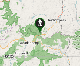
Drive 2 hours south of Brisbane to the Yellow Pinch reserve car park at the southern end of Upper Logan Road

Route/Trail notes

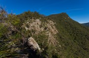
The northeastern ridge route starts off on the fire road to the southern Mount Barney routes before branching off and crossing the Logan River three times. The bottom of the northeastern ridge starts as a grassy slope, before you quickly encounter steep bands of rock. There is more than one feasible route through here, but all are steep and require caution. From there, the ridge ascends several false summits and any scrambling is generally straightforward, with the exception of an unavoidable exposed downclimb (though plenty of holds are available). It's advisable to have navigational aid, as a faint track only exists in places. Remember not to stray too far from the ridge.

A small rock cairn marks the summit, with a rocky platform providing a great place to enjoy views of Mount Barney. Views of Mount Lindesay are limited to some of the earlier sections of the ridge, as it is obscured by vegetation at the summit.

Permits

All documented summit routes involve traversing private property (see notice at top).

Other References

https://www.npsr.qld.gov.au/parks/mount-barney/

http://www.southee.com/Bushwalking/Ch13-BarneyBallow.html#label066

Comments

We did a variation of this walk that didn't involve crossing private property (apart from the road from Yellowpinch to the Logan River). After crossing at the ford, we followed the road to the first campsite, then left the road and headed south, crossing Cronan Creek, then over a couple of low ridges before reaching the base of Mt Ernest towards its northeastern end. Then it was a matter of heading straight up the steep, loose slope (watching out for rock falls from your companions). As we approached a small saddle we found a break in the cliff line and came onto the main ridge just beneath the first of the false summits on the northeastern approach (described above). Then it was a case of following the ridge to the summit, sticking closely to the northern cliffs. There were areas of mild exposure and there were footpads in places, but as has been suggested, taking a navigational aid was a good idea, as there were a couple of ridges that can lead you astray. Unfortunately, following the bushfires of 2019, there has been a lot of regrowth, so views from the summit were limited (though there were views on the way up). We returned by retracing our steps, with the loose slope coming down from the saddle the most difficult section. Make no mistake, this was a difficult walk, I thought it more difficult than Mt Barney, because of the steep loose sections and false summits. Don't attempt this walk in summer!

Michael D on 21 Sep, 2024

Well the other people who have done this weren't lying, it's quite a hard climb. It's not as physically exhausting as Barney but the track is for the most part ... non existent, but as others have said so long as you follow the ridge line you should be alright. And for everyone's information if you want a direct number to call to enquire about permission for this walk it is 55441222 (Rathdowny info centre).

The walk pretty much has 4 stages - Stage 1: Walk from Yellowpinch, through the private property gate (with permission) up to the base of the mountain Stage 2: Up a steep boulder covered slope where you are constantly sliding and falling over and looking for snakes (I did see one) Stage 3: Scrambling up the precarious cliffs Stage 4: About the last quarter you spend just hiking along a rough track to the summit.

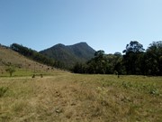
Recommend a GPS so you can follow the path of least resistance and also be mentally prepared for what is in store. There are a lot of false summits and it's less soul destroying when you expect them. The view at the top is alright - pretty much a direct side on view of Barney East and West. I've included photos of view from the bottom and the top.

Vonsnrub on 16 Jan, 2019

WOW ...... SO HARD ... WENT UP WESTERN ROUTE .....

Ted n Jo on 1 Jan, 2019

Great walk, really enjoyed it. Heaps of scrambling involved, but nothing too difficult, though might be tricky if
You aren’t used to scrambling or climbing. Along as you stick to the ridgline, you shouldn’t have too much trouble, though it would be wise to have some sort of navigational aid to assist you. Great views of Barney along the way. It doesnt look high compared to Barney but it’s still quite a big walk. Took us about 5hrs all up. Would do it again for sure

B_razzle on 1 Sep, 2018

Where

Click here to load this map.

Nearby Walks

Done this walk?

This walk has been ticked 12 times

Aussie Bushwalking can keep track of your bushwalks.

Login/signup to tick this walk off.

Tick walks to keep track of where you've been. You must Login to tick walks. Accounts are 100% free so sign up if you don't have one.