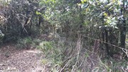
This is one for the "peak-baggers" and those who want to test there fitness. Mt Clunie is one of the high mountains (1158m) on the Qld/NSW border and the walk involves one of the tougher ascents in South-East Qld (described as "incredibly steep" in the Bushpeople's Guide, and they aren't joking). The walk begins at the border gate on the Carneys Creek Rd (this becomes White Swamp Rd once it crosses into NSW) and follows the border fence all the way up to the summit. The first few kilometres of the walk, in a roughly Southerly direction, is through undulating terrain in open eucalypt forest, and although there are some steep sections, it isn't too difficult. However, about an hour into the walk, a steel fence is crossed, the vegetation begins to change to rainforest, and the very steep section commences. At this point is is very handy to wear tough gloves, in order to drag yourself up the fence, and wear long sleeves and pants/gators, to battle through some areas of blackberry. A few hundred metres from the summit, the track levels, and there are some picturesque rock formations on the Qld side of the fence. In some sections, it is best to climb over the fence for easier travel. The summit is marked by a cairn, but there are no views to speak of, apart from occasional glimpses of Wilson's Peak to the North-West. You will make up some time on the return trip, but in parts, it's almost necessary to slide back down!

Scrambling or Climbing
Rainforest
Eucalypt Forest
1158m
Maximum Elevation
696m
Total Climb

Getting there

How do you get to the start of the walk?

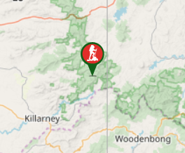
Carneys Creek Road Qld/Nsw Border

Maps

Which maps cover the area?

Route/Trail notes

A detailed description of the walk!

Permits/Costs

Do you need any permits? What's the cost?

Other References

How can I find more info? Any guide books?

GPS Tracks

  • No GPS available for this walk yet.

Comments

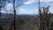
Directions to the starting point were accurate, although it was a bit intimidating hopping the gate to follow the border fence when technically the road is closed due to COVID. The first 2/3 of the hike is undulating and relatively pleasant with occasional views of Wilson's Peak. Then you reach the beginning of the steep section and it quickly becomes rather unpleasant. I think there must have been some fires through this area which brings some good news and bad news - good news: you get some nice views while you are climbing up, Bad news: Everything that has regrown has spikes, thorns, prickles and other spikey ornaments attached to it. Makes it very difficult when you are trying to walk up a 45 degree slope but you can't touch the ground because the dirt is filled with spikes, the rocks are covered in prickles, and the branches are all covered in thorns. My advice would be to wear long pants, sleves and have some gloves. When you get into the rainforest section it becomes nice again - still steep but nowhere near as hard going. No view from the top but still a well spent day. Can't believe that fence goes all the way to the top, the photos don't do it justice, it is diabolically steep!

Vonsnrub on 12 Nov, 2020

I did this walk today. According to Google Maps it's about 5km from the border gate to the summit. It took about two hours each way, without stops. The Bushpeople's Guide described "interesting views" but I didn't see too many. The prettiest part of the walk is in the montane rainforest near the summit. Given the steepness of the climb this one is definitely for the cooler months.

Michael D on 9 Jul, 2019

Where

Click here to load this map.

Done this walk?

This walk has been ticked 3 times

Aussie Bushwalking can keep track of your bushwalks.

Login/signup to tick this walk off.

Tick walks to keep track of where you've been. You must Login to tick walks. Accounts are 100% free so sign up if you don't have one.