Mount Vane (Jarlo Beetle Track)

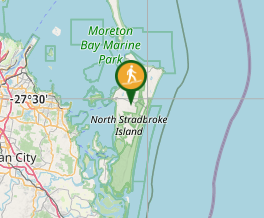
North Stradbroke Island - Minjeeribah

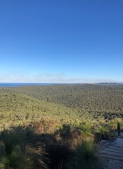
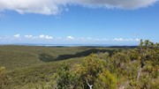
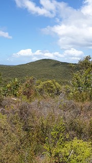
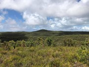
The Mount Vane walking track on Minjerribah is Straddie’s latest visitor attraction. Recent completion of the track has allowed keen bush walkers to enjoy 360-degree views of Moreton Bay and Quandamooka Country from a lookout atop one of Minjerribah’s highest peaks.

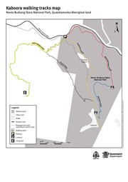
Constructed by Minjerribah’s Traditional Owners, the Quandamooka People, the new walk joins two existing walks within Naree Budjong Djara (My Mother Earth) National Park to create a 10 kilometre network of trails. This offers walkers a half day of trekking to special sights like Karboora (Deep Silent Pool, also known as Blue Lake) and a number of peaks with sweeping views over 18 Mile Swamp to the Gold Coast.

Lookouts
Heritage Sites
Coastal
Swamp or Wetland

Getting there

Starting from Dunwich, travel east on Alfred Martin Way past the Brown Lake turnoff and the golf course until you reach the Naree Bujong Djara National Park car park on the right hand side of the road.

Route/Trail notes

The track is easy to follow. No map is required. There is an information board at the start of the walk which shows the different walks available in the area.


GPS Tracks

  • No GPS available for this walk yet.

Comments

Nice walk worth the view at the top

Kmxfitness on 19 Jun, 2021

Nice walk and view from the top to the east, south and west. Took 2 hours from car park.

becdr on 19 Jun, 2021

Good short walk on a sandy track. It took us about 2hrs 10mins, including plenty of stops for views, time at the viewing platform at the top, wildflower pics and cicada spotting (there are heaps this time of year).

We started from the car park then went straight up hill. We turned right at the junction between the Kabul and Jarlo Beetle tracks.

The track isn't hard per se, but there are plenty of uphill sections and the sand makes things a little more taxing on the legs. There are a few stairs towards the top. That said, there are plenty of flat sections too. The main thing to consider is that this walk is fairly exposed for much of the way. Combine that with sand reflecting the heat back at you and it can get pretty hot. We started the walk about 9am, but it was still pretty warm (prediction for today was about 31 degrees). Take a hat, wear plenty of sunscreen. The track is probably best done at cooler times of year.

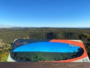
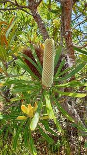
There were lovey little wildflowers, an abundance of grass trees, birds and insects and glimpses out to sea along the way. There were a few interpretive panels, still very clear znd providing interesting information on local fauna and flora. The view from the top is good - bring some binoculars to take a closer look. Another bonus is that, at least today (and the island is busy at the momenr), the track seems pretty quiet. We only saw two other people on the track.

On the way back, either come back the way you came or head down rhe Kabul track at the junction. This will add an extra hour or three (depending on the options you take)

Tip: if you're good at early mornings (unlike me), this may be a good place to see the sun rise. Be on the look out for orb weaver webs. They seems to love to spin them across this path :-)

Peta Statham on 26 Jan, 2021

Where

Click here to load this map.

Nearby Walks

Done this walk?

This walk has been ticked 5 times

Aussie Bushwalking can keep track of your bushwalks.

Login/signup to tick this walk off.

Tick walks to keep track of where you've been. You must Login to tick walks. Accounts are 100% free so sign up if you don't have one.