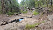
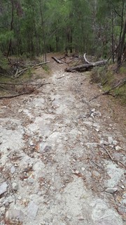
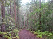
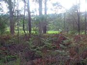
Cooler winter months are the best time to explore this circuit. It winds through open scribbly gum forest and includes large sections of track with little shade.
A number of creeks lead to rock pools and cascades, which flow after heavy rainfall.

Bird Watching
No Dogs Permitted
Horses Permitted
Cycling Permitted
No Trail Bikes Permitted
Rainforest
197m
Maximum Elevation
109m
Total Climb

Getting there:

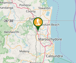
Access the main entrance at Radar Hill Road, Kulangoor.

From the south, exit the Bruce Highway at the Nambour Connection Road/Parkland Exit. Turn right, and after 200m, turn right back over the Bruce Highway as if you were joining the highway to go south. Just over the bridge, turn right into Radar Hill Road.

From the north exit off the Bruce Highway at the Nambour Connection Road/Parkland exit and turn left into Radar Hill Road before it crosses over the highway.

Maps:

Parklands Conservation Park

Route/Trail notes:

From the gate on Radar Hill, take the main track down for 600m and turn right (un-signposted) at the bike assessment area. Follow this undulating track for 600m and turn right along the overgrown Under Hill track (un-signposted), which spits you out onto a gravel road at the back of the quarry.

Turn left up the road till you reach the mobile tower and enter the forest again through the gate on your left. Follow this out to the far side of the park and at the junction with Lemon Tree Circuit (signposted) turn right downhill and circle around till you reach another gate onto the gravel road. Turn right along the road, past the first gate and return by the same route. 

Permits/Costs:

None.

Other References/Comments:

As signposting can be a little vague, it is suggested you print off a copy of the tracks from the website link above. Be aware, that the tracks are 'shared' with horse riders and in some section mountain bike riders.

GPS Tracks

  • No GPS available for this walk yet.

Comments

We felt totally confused trying to follow this track. A few signs on the many paths would have helped. The walk tracks are poorly signed. Wish we'd taken mosquito repellent!

Viv Brown on 13 Apr, 2019

This was the most confusing walk and even with the map, I made a mistake, going straight out to the far side of the park, instead of turning right down Under Hill track.

F.A.B. on 18 Feb, 2019

The access to the track is just off the highway on Bli Bli Rd, you have to walk up another track to get to it. Signage is confusing, back although we back tracked a few times it was still enjoyable, with large paths, some lovely creek crossings, and some pretty big hills to get a sweat up.

There is some signage saying track upgrades will be down from June 2017, and evidence that supports that, hopefully it includes better signage.

Museum of Jus on 18 Jun, 2017

I agree with the earlier comments about signage for the walking trails. It seems most of the signs are for the Mountain Bike tracks and not the walking trails. I was able to follow the path most of the way, however I ended up taking a detour via bike track 5, 6 & 9 before I found the walking trail again

Lee on 15 Nov, 2016

due to the terrible signage we ended up walking a mountain biking track and turning back the way we came after an hour. revisited the next week and found the walking tracks but badly signed so need your intuition in check. Good walking though, we did a circuit of all the walking tracks, was about 15km

Bec R on 5 Mar, 2016

Day 4 , hike 4 and the hardest for last........this one has again steep hills.....opens up a bit more at once stage walking past private properties , wide track and local horse riders about

J on 14 Jan, 2015

Where

Click here to load this map.

Nearby Walks

Done this walk?

This walk has been ticked 11 times

Aussie Bushwalking can keep track of your bushwalks.

Login/signup to tick this walk off.

Tick walks to keep track of where you've been. You must Login to tick walks. Accounts are 100% free so sign up if you don't have one.