Cougal Cascades to Boyd’s Butte and Mt Cougal East Peak

Springbrook National Park

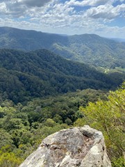
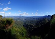
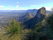
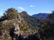
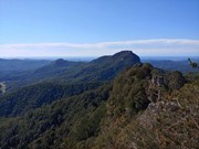
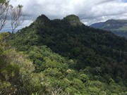
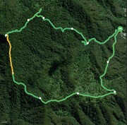
A circuit walk from Cougal Cascades to Boyd's Butte and Mt Cougal. Includes views from both peaks.

Waterfalls
Lookouts
Swimming
Picnic Facilities
Toilets
Scrambling or Climbing
No Dogs Permitted
No Camping Permitted
Rainforest
569m
Maximum Elevation
924m
Total Climb

Getting there:

Drove car and parked at the Cougal Cascade parking area,

Maps:

QTopo has topo maps covering the area.

Route/Trail notes:

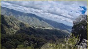
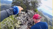
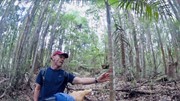
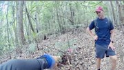
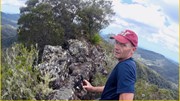
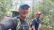
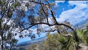
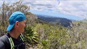
Parked car at the Cougal Cascade then walked to the old Saw Mill which is about 1.2k easy walk on sealed path, then 150 meters up the creek we looked for a trail at the sharp bend in the river, once we found this, some good people had marked the trees with pink ribbons so we could find our track. Boyd’s View is much better than Cougal but very dangerous at the top. The walk is not difficult, it’s pretty long doing the loop but the two views are worth the trouble. We did the entire circuit and was moderate in difficulty.

Permits/Costs:

None.

Other References/Comments:

Video which may help.  https://youtu.be/cdic-lWOVss

Comments

A great walk. Easy to loose the trail between Boyde's Butte and Mt Cougal. Useful to have a compass bearing for this leg. Would recommend long sleeves and gloves to deal with the lawyer vine. Also ran into the same issue as Max and came of East Cougal on the wrong track. Realised when I got to the border fence. I should have taken a compass bearing when leaving the summit. I contoured around, but wouldn't recommend it. Lawyer vine was awful and some loose scree on slopes. Probably would have been better to go up to the summit.

Gerard on 3 Sep, 2024

Awesome hike! I didnt realise this one would take 6 hours. I went the wrong way coming back down the East Cougal peak. There is a part where the tags split off in two directions - one takes you onto the cougal track (I knew I went the wrong way when I found the fence). Dont go this way if you parked in the cascades car park. I had to hike back up and its steep so was annoying! Make sure you go the same way you went up. On the way back I also got disorientated in the rainforest between the east cougal peak and boyd’s butte. There seems to be multiple lots of tags. I ended up doing circles and sometimes couldnt see the tags. As it was starting to get dark by the time I was in that section it was harder to see them. I was so glad I packed a head lamp. At one point I thought Id have to stay over night until it was bright again. I made the mistake starting too late in the day. Started at 11:30am and took me like 6 hours due to getting off track and doing circles. Finished the hike in the dark and had a refreshing night dip in the cascades. Even though there were a few hiccups I really enjoyed this hike.

Max on 17 Oct, 2023

Tough, don’t recommend jumping on spiky trees 🌲 but loved the swims

Alia on 26 Apr, 2023

Challenging trail with good views. Went up to Cougal East and back the same way.
Have uploaded the .gpx (one way and back to the saddle where I lost the trail...). Seems one way 3.8km, it took me about 4 hrs return with a swim at the end.
Start (after coming back down it was easy to find) is about 150m past sawmill at the left tributary that has got a swimming hole in sight (30m from creek). Cross this hole to the left and continue mid with few markers found within 25m. Soon distinct ridge path is formed. Easy to follow to Butte top, have accessed 2 of its few peaks. Then followed the Ridge line towards Cougals. After a short time it flattens out and becomes harder to follow also due to vines and fallen trees. In about 15mins starts to rise quickly, well marked from there. Pay attention to last marker where it joins the border track just below the peak, it is easy to miss this turn when coming back down.
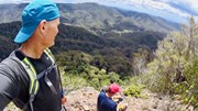
Great views from the both Butte and Cougal peaks!

In total about 4hrs with a swim at bottom. Will come back to explore Butte more.

igorh on 27 Jun, 2021

On the trail you are a world away from the visitor bustle close to the car park.

Wanderlust on 26 Dec, 2020

Parked car at the Cougal Cascade then walked to the old Saw Mill which is about 1.2 k easy walk on sealed path, then 150 meters up the creek we looked for a trail at the sharp bend in the river, once we found this, some good people had marked the trees with pink ribbons so we could find our track. Boyd’s View is much better than Cougal but very dangerous at the top. The walk is not difficult, it’s pretty long doing the loop but the two views are worth the trouble. We did the entire circuit and was moderate in difficulty. Here is my video which may help. https://youtu.be/cdic-lWOVss

miike2000 on 10 Nov, 2020

Where

Click here to load this map.

Done this walk?

This walk has been ticked 16 times

Aussie Bushwalking can keep track of your bushwalks.

Login/signup to tick this walk off.

Tick walks to keep track of where you've been. You must Login to tick walks. Accounts are 100% free so sign up if you don't have one.