- Pyros Loop (White Rock - Spring Mountain Conservation Estate)
- Six Mile Creek Boardwalk (White Rock - Spring Mountain Conservation Estate)
- Yuddamun Trail (White Rock - Spring Mountain Conservation Estate)
- Bluff Lookout Circuit (White Rock - Spring Mountain Conservation Estate)
- Little White Rock Track (White Rock - Spring Mountain Conservation Estate)
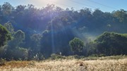
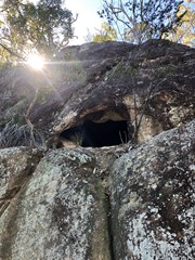
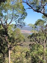
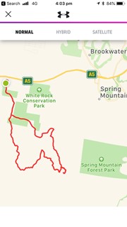
A varied terrain walk. Sandy in parts, then really rocky in some. The first part of the walk I followed mainly the Spring Mountain fire trail which was mostly flat. When I got to Back Alley trail it started inclining for about 2kms till I got to the Spring Mountain. I climbed as far as the first cave I came across then didn’t climb the rest... although it looked doable, I was by myself and didn’t want to push my luck. It was about 10km on the way up. Return trip I went down the Daisy trail which seemed to be an old mountain bike trail. It descends quickly and is rocky, eroded in parts and hard to walk on and requires a lot of scrambling and concentration. I then got to Narelle’s Climb, this terrain has been gravelled at some stage. I also saw a red belly black snake!! I decided to bypass White Rock as I’d seen it enough times and head back to where I started. Was about 9km on the way back. If I do it again I will do it in reverse and go via White Rock.
Getting there
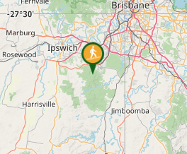
How do you get to the start of the walk? Drove to Paper Back Flats Picnic Area, School Road Redbank Plains
Maps
Which maps cover the area? Gaia GPS & Google Maps
Route/Trail notes
A varied terrain walk. Sandy in parts, then really rocky in some. The first part of the walk I followed mainly the Spring Mountain fire trail which was mostly flat. When I got to Back Alley trail it started inclining for about 2kms till I got to the Spring Mountain. I climbed as far as the first cave I came across then didn’t climb the rest... although it looked doable, I was by myself and didn’t want to push my luck. It was about 10km on the way up. Return trip I went down the Daisy trail which seemed to be an old mountain bike trail. It descends quickly and is rocky, eroded in parts and hard to walk on and requires a lot of scrambling and concentration. I then got to Narelle’s Climb, this terrain has been gravelled at some stage. I also saw a red belly black snake!! I decided to bypass White Rock as I’d seen it enough times and head back to where I started. Was about 9km on the way back. If I do it again I will do it in reverse and go via White Rock.
Permits/Costs
Free
Other References
Gaia GPS is really good and will show up trails that Google doesn’t show and give your position.
GPS Tracks
- No GPS available for this walk yet.
Where



 19.07
19.07 4
4
Comments