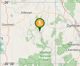
Mt Widgee

Wide Bay Burnett

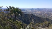
Nice relatively easy ,if you're fit ;-) , up to Mt Widgee to enjoy awesome views across Wratten Forrest.

Lookouts
4WD Required
Trail Bikes Permitted
Eucalypt Forest
700m
Maximum Elevation
700m
Total Climb

Getting there

From Widgee town turn into Upper Widgee Rd ( gravel , 2WD accessable ) follow this till you hit the intersection with Quandong Rd. This road turns into 4WD mode and is really for 4WD only ! Keep going for a few kilometers till you hit a turn that has a track on the right. Park car here!

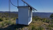
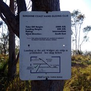
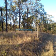
Follow that track which is a narrow 4WD track with some steep sections and rocky ground. About 4km in you will come across a hanglider launch site. From there it's another 1k to the end of the road, bit overgrown and a steep section just at the end. Top is covered with grass trees , there's a weather station and awesome views across the local area.

Maps

Set GPS for Quandong Rd in Widgee , it'll get you there easy

Route/Trail notes

As per above

Permits/Costs

Free

Other References

The hangliding webiste makes a reference to Mt Widgee yet does not provided much other info and ignore their locked gate comment. Gate is open and does not seem to function anymore.

GPS Tracks

  • No GPS available for this walk yet.

Comments

Took the 4WD track all the way to the ridgeline after the paragliding site. Some muddy/slippery spots on the 4WD track so take care after rain on this track. Lovely walk with great outlooks. Will be back for sunset/sunrise.

courtlalala on 10 Jul, 2021

Was a bit nervous about driving to this one considering the description really emphasizes it is 4wd only. Took my Subaru Forester up to the parking area and it was a pretty decent road. Probably wouldn't want to take a Getz or a low car up there, but certainly an suv with a bit of clearance isn't going to have any trouble.

From there it is a pretty undulating walk along an actual 4wd track that follows the ridgeline . There are some good views, especially when you reach the hangliding launch area where the view is fantastic. Walk a bit further and you will reach the end of the road where you will have to take a faint footpad off to the right to get to the summit. The track is pretty clear, sometimes hidden by the masses of grass trees. If you continue far enough you get to what appears to be a weather station and the view there is absolutely stunning. Kind of similar to the Spring Mountain walk except there's only one road, and the view is a lot better. Only place you may run into trouble is retracing your steps and getting from the summit back to the 4wd track, so just be vigilant on the climb so you remember where to descend.

Vonsnrub on 24 Aug, 2020

Nice hike , no other souls about :-)

J on 10 Nov, 2018

Where

Click here to load this map.

Nearby Walks

Done this walk?

This walk has been ticked 4 times

Aussie Bushwalking can keep track of your bushwalks.

Login/signup to tick this walk off.

Tick walks to keep track of where you've been. You must Login to tick walks. Accounts are 100% free so sign up if you don't have one.