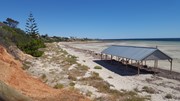
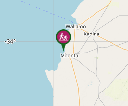
A coastal track and beach walk, with its interpretive signage, between the jetties of Moonta Bay and Port Hughes to the south.
Getting there:
The walk starts from the slipway next to jetty at Moonta Bay at the end of Bay Road.
Maps:
Route/Trail notes:
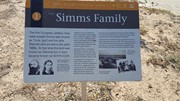
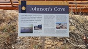
Turn left along the beach from the slipway, past various historic sites until you reach a rocky outcrop at Simms Cove. Climb the stairs to join the track along the cliff, ignoring the detour sign, as the pathway is open. Continue on this pathway all the way to the jetty at Port Hughes
Return by the same route.
The walk can be completed in either direction and done entirely on the beach at low tide.
Permits/Costs:
None.
Other References/Comments:
Moonta Bay is also the stepping off point to 'Walk The Yorke', a 500km walk around the coast of the Yorke Peninsular to Port Wakefield.


 338 Port Hughes Coastal Trail (GPX)
 6
6 2
2
Comments