


 2.3
2.3 1
1- D’Alton and Fergusson Falls (Cradle Mountain-Lake St Clair National Park)
- Mount Pelion East (Cradle Mountain-Lake St Clair National Park)
- Mt Ossa Climb (Cradle Mountain-Lake St Clair National Park)
- OVERLAND TRACK, TASMANIA (Cradle Mountain-Lake St Clair National Park)
- Pine Valley (Cradle Mountain-Lake St Clair National Park)
Hartnett Falls
Cradle Mountain-Lake St Clair National Park
Menu
Follow the trail down to the top of Hartnett Falls. From here the trail follows the cliffline downstream before hooking down to the river. From here depending on water levels you can go right out to the base of the falls.
Waterfalls
Lookouts
Swimming
903m
Maximum Elevation
72m
Total Climb
Getting there
How do you get to the start of the walk?
From the track junction with the overland track.
Maps
Which maps cover the area?
Overland Track Maps.
Route/Trail notes
A detailed description of the walk!
Follow the trail down to the top of Hartnett Falls. From here the trail follows the cliffline downstream before hooking down to the river. From here depending on water levels you can go right out to the base of the falls.
Permits/Costs
Do you need any permits? What's the cost?
Free
Other References
How can I find more info? Any guide books?
https://parks.tas.gov.au/explore-our-parks/cradle-mountain/overland-track/overland-track-walk-notes#:~:text=%E2%80%8B%E2%80%8B%E2%80%8BBarn%20Bluff,not%20recommended%20when%20under%20snow.
GPS Tracks
- No GPS available for this walk yet.
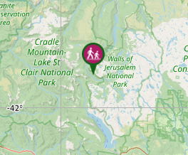
Where
Click here to load this map.
Comments
Nobody has commented on this walk yet. If you've done it then tick it off and add a comment.