
Evercreech Falls Track
Tasmania


Menu
A walk to a small waterfall.
Waterfalls
398m
Maximum Elevation
44m
Total Climb

Getting there
How do you get to the start of the walk?
The end of Egans Rd
Maps
Which maps cover the area?
Map of Evercreech Regional Reserve
Route/Trail notes
A detailed description of the walk!
From the reserve carpark cross the little bridge over Evercreech Rivulet and follow it upstream to the falls. After visiting the falls take the trail back over the rivulet where eventually you will reach a 4wd trail which links back to the end of Egans Rd
Permits/Costs
Do you need any permits? What's the cost?
Free
Other References
How can I find more info? Any guide books?
GPS Tracks
- No GPS available for this walk yet.
 2.1
2.1 45
45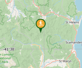
Comments
Nobody has commented on this walk yet. If you've done it then tick it off and add a comment.