
Mount Snowy and Hartz Peak Track
Tasmania


Menu
An off trail walk to add onto a hike to

Getting there
How do you get to the start of the walk?
From Hartz Mountains National Park visitor information centre at the end of Hartz Rd
Maps
Which maps cover the area?
Maps of Hartz Mountains National Park
Route/Trail notes
A detailed description of the walk!
Take the usual route out to Hartz Peak then once at summit head down the Southern ridge to access the saddle to Mount Snowy which you will then summit and return to saddle. You will then continue to Emily Tarn and then Arthurs Tarn. Follow the outlet creek and then a trail back to the main trail. The route isn't too bad if you can stick to most well used trail though their are false paths that make the bush bashing harder.
Permits/Costs
Do you need any permits? What's the cost?
Free if you already have parks pass.
Other References
How can I find more info? Any guide books?
GPS Tracks
- No GPS available for this walk yet.
 10
10 4
4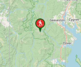
Comments
Nobody has commented on this walk yet. If you've done it then tick it off and add a comment.