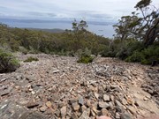
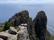
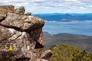
Mount Maria (711 m) is the highest point on the island, and offers sweeping views up and down the Tasmanian coast. The last part of the track goes up a scree slope with some clambering up (or down!) large boulders just before the summit.
Getting there
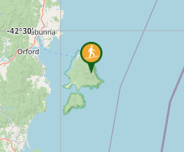
One of the many walks on Maria Island, which is reached by a regular ferry from the town of Triabunna (multiple daily services in summer; less frequent in winter). The distances for this walk are based on starting at Frenchs Farm campground - if starting at Darlington it would be about 46km return via the Coast Road (feasible by bike but a very long day-walk).
Maps
TASMAP Maria Island National Park 1:50K
5828 Darlingon 1:25,000 (covers top of Maria Island)
Route/Trail notes
From Darlington head south along the Coast Road, and turn onto the Inland Track just after Counsel Creek. After crossing two bridges, the junction with the Mount Maria Track is reached. This bush track ascends initially through eucalypt forest and then over a scree field to the summit.
Permits/Costs
There is a cost for the ferry to reach Maria Island. A National Parks Pass is also required`
Other References
- Tas Parks Maria Island web site
- Tas Parks datasheets - Mt Maria
- https://hikingtheworld.blog/2019/01/10/mount-maria-hike-maria-island/
GPS Tracks
- No GPS available for this walk yet.


 18
18 5
5
Comments