Along the Gar and Werdug 3-day hike, you'll witness seasonal waterfalls, mountain summits and clifftop camping. The track is an overall Grade 4 walk with steep terrain, suitable for fit and experienced hikers.
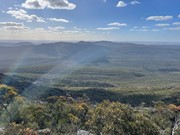
This section of the trail is particularly spectacular in winter, spring and after rain, when clifftop rockpools and seasonal waterfalls are at their best. Gar (meaning "big mountain") is the highest on the western side of the range, rewarding walkers with spectacular 360-degree views. Lake Wartook Lookout, at 829m, is one of the highest points on the eastern side of the Mount Difficult Range with sweeping 360-degree views of Gariwerd.
Route/Trail notes
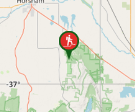
Day one: (N2) Gar Trailhead (Roses Gap Road) to Gar Hike-in Campground (7.3 kilometres)
Begin your journey at the Gar Trailhead (Roses Gap Road; N2 on GPT topographic map). Along the 7.3-kilometre rugged, rocky adventure you'll experience steep climbs and panoramic views including the seasonal waterfalls of Gar. As the trail zig zags upwards, uninterrupted views to the north are revealed. You will climb through stunted eucalypt forest, past boulders and over rocky slabs on the edge of the Mount Difficult escarpment taking in views over nearby mountains, Wartook Valley, Asses Ears and the Black Range (Burrunj). Arrive at the Gar Hike-in Campground, perched on a spectacular cliff top high above the valley below. You'll be spending the night camped along the rocky terrace, perfect for watching the sunset.
Day two: (N3) Gar Hike-in Campground to Werdug Hike-in Campground (14.1 kilometres)
From the hike-in campground, take a side trip to the rocky summit of Mount Difficult (Gar). Enjoy the sunrise before traversing south towards Lake Wartook along rocky ridgelines. The trail rises and falls over highpoints and through mountain saddles, before finishing on a high knoll at Werdug Hike-in Campground. The campground provides views over Lake Wartook and across the Mount Difficult Range.
Day three: (N4) Werdug Hike-in Campground to Halls Gap (13.0 kilometres)
Start with a steady climb to Lake Wartook Lookout for spectacular views and a morning tea break. Enjoy the sweeping views to the North, west and southern of Gariwerd. To the west is Lake Wartook with Bear Island in the middle, the western Mount Difficult Range, Asses Ears and the Black Range (Burrunj) in the far distance. To the south, Mount William (Duwul) dominates the skyline, curving from The Sentinel at the northern tip around to the highest mountains in the park - Redman Bluff and including Mount William (Duwul) and the Major Mitchell Plateau massif. The Grampians Peaks Trail crosses these high mountains in the Duwul and Durd Durd 3-day Hike. Leaving the Lake Wartook lookout, make the descent passing rocky outcrops through lower vegetation with the last views over the Mount Difficult Range. Leaving the dry and rocky northern Grampians and moving onto the wetter eastern slopes, the trail gently descends through a canopy dominated by Messmate and Brown Stringybark with an open understorey featuring ferns, grasses, wattles and tea trees. Take a short detour to Chatauqua Peak (Bim) before descending through tall forest, rich with birdlife and wildflowers, completing your journey in Halls Gap.
Permits/Costs
A permit booked through national parks is required to camp at the Gar and Werdug campsites.
Other References
GPS Tracks
- No GPS available for this walk yet.


 34
34 3
3
Comments
Nobody has commented on this walk yet. If you've done it then tick it off and add a comment.