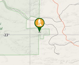
Highest mountain of WA at 1249 m.
You can actually drive to the top but would require a 4WD.

Lookouts
4WD Required
Navigation Required

Getting there

From Newman, WA via Great Northern Highway, Packsaddle & Juna Downs Road.

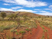
Dirt roads that get progressively lesser in quality until you start up the ridge.

Choose somewhere to park and walk the road to the top.

Where you stop your vehicle may depend on what vehicle you have.

Maps


Route/Trail notes

Follow the road that takes you to the top.

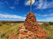
There is a large cairn on the top with some history.

Permits/Costs

Flights, 4WD, a courtesy call to the road owners.

It is in Karijini National Park therefore you should probably pay the entry fee.

Nowhere there to do that at Meharry, go visit the gorges while you are there and contribute your fee then.

Other References


GPS Tracks

  • No GPS available for this walk yet.

Comments

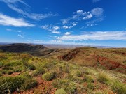
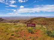
From Newman you drive along the Great Northern Highway looking out for a dirt road on your left. There are no signs for the road so it is much easier to look out for a right turn to Coondewanna Airport which is only 100m or so past the left turn to Meharry. The road in gets progressively rougher (especially passing the turn off to the mine) and I would definitely recommend a 4wd. I was driving a Mitsubishi Outlander that was probably a little inadequete. It bottomed out on one part, and just before the railway there were heaps of flooded sections (due to rain in the past week). I was quite nervous I would get bogged but fortunately I kept up momentum and made it past the railway crossing. Eventually you get to a point where it is clear you won't get any further unless you have better clearance so you park your car and start walking. The walk itself is actually quite easy, just following a 4wd track up the mountain. It is a pretty steady incline for an extended period of time but the views get better and better the higher you climb. At the top you are greeted by a sign and a massive monument along with some very nice views of the surrounding desert. Mt Bruce is a far superior mountain in my opinion but it was nice to knock off the highest in the state. Didn't see any other people from the time I turned off the highway to the time I got back on it, so probably a good idea to invest in a PLB and bring lots of water because it's 39km from the top of the peak to the highway with a whole lot of desert in between.

Vonsnrub on 29 Mar, 2021

Cloudy, blowing rain showers, no view, still good to climb it

drewmac on 21 Jul, 2015

Where

Click here to load this map.

Done this walk?

This walk has been ticked 3 times

Aussie Bushwalking can keep track of your bushwalks.

Login/signup to tick this walk off.

Tick walks to keep track of where you've been. You must Login to tick walks. Accounts are 100% free so sign up if you don't have one.