Talyuberlup Peak

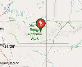
Stirling Range National Park

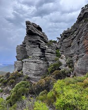
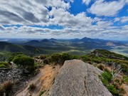
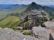
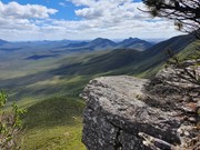
A steep and challenging hike/climb to the top of Talyuberlup Peak which hosts impressive rocky outcrops near the summit and a hole straight through the mountain.

Lookouts
Scrambling or Climbing
Arid or Desert
783m
Maximum Elevation

Getting there

Driving along Stirling Range Drive look out for the signs for Talyuberlup Peak and a small car park on the side of the road. 

Route/Trail notes

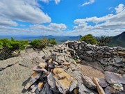
The walk starts off as a relentlessly steep walk on a very well marked trail through thick vegetation. It gets steeper the further you go and eventually leads to a scramble up a rocky outcrop to the summit. 

Permits/Costs

$15 per car per day

Other References

https://trailswa.com.au/trails/talyuberlup-walk-trail


GPS Tracks

  • No GPS available for this walk yet.

Comments

Fantastic hike with spectacular views! Most interesting hike of the Stirling ranges😁

Elese on 10 Jan, 2023

Fantastic hike with spectacular views! Most interesting hike of the Stirling ranges😁

Elese on 10 Jan, 2023

Not sure if it's because this was my third mountain of the day, but I did find this one unexpectedly exhausting. It is relentlessly steep the entire way. There are no views until you are nearly at the top but once you make it all your effort is very worthwhile. Check out the cave near the top which allows you to see through the mountain (not allowed in it due to risk of rock fall, but you can see through from the outside). Probably the most challenging scrambling section of any of the Stirling Range mountains I did - but in saying that it's not any harder than anything you would find on Mt Barney.

Vonsnrub on 26 Mar, 2021

Where

Click here to load this map.

Nearby Walks

Done this walk?

This walk has been ticked 3 times

Aussie Bushwalking can keep track of your bushwalks.

Login/signup to tick this walk off.

Tick walks to keep track of where you've been. You must Login to tick walks. Accounts are 100% free so sign up if you don't have one.