Hell Hole Falls

Mt Jerusalem National Park

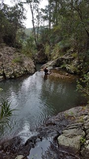
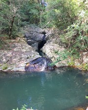
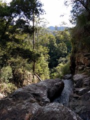
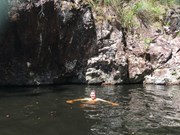
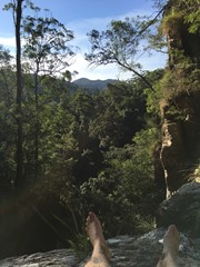
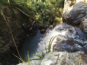
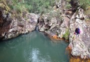
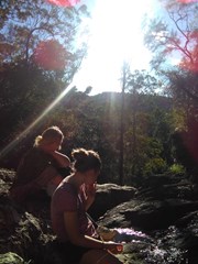
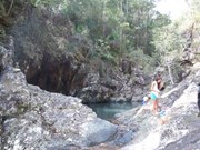
This is a well kept secret, that not even many of the locals know about! A strange name for such a beautiful place; it is a series of deep rock pools linked by small waterfalls before the creek plunges over the cliff into the Tweed Valley.
This rock formation is not part of Mt Warning's eruptions, but dates back before that time to the Chillingham volcanics.
A place for a cooling swim, picnic and to enjoy the tranquillity of the surroundings. It is rumoured that the waters of the rock pools contain a natural hair conditioner that lasts for weeks.

Waterfalls
Lookouts
Swimming
Bird Watching
Scrambling or Climbing
No Dogs Permitted
No Camping Permitted
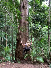
Rainforest

Getting there:

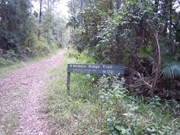
Leave Mullumbimby on Main Arm Road. It becomes Skyline Road just before you enter Mt Jerusalem NP and then Manns Road beyond the junction of Middle Ridge Road, which will ultimately take you all the way to Uki. There are great views of the imposing cliffs of Mt Boogarem to your left. After 16.8km (the last 2.5km are gravel road), turn left into Middle Ridge Road and travel a further 1km to where you will see a gated track to the right called Middle Ridge Trail. There is room to leave cars here.

Maps:

None found.

Route/Trail notes:

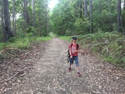
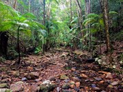
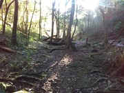
From the Middle Ridge Track gate, follow the trail down for 1km till you reach a fork in the road; take the track to your left, (pink ribboned) for 0.7km till you reach an old bridge over the creek. Watch your step, as the bridge has big holes in it. Immediately after the bridge, take the faint path to your right that runs along the edge of the creek (pink ribboned). The rock-pools are 200m along the creek.

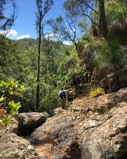
You can rock hop down to the first ledge of the falls (about 20m), but to continue to the bottom would require a bush bash down the left hand side of the gorge.

The route is not difficult, representing a 200m drop from the gate to the falls, but in places large trees have fallen across the pathway.

Permits/Costs:

None, but you get the reward!

Other References/Comments:

Book: Bushwalking in the Mt Warning Region.

Comments

Nice walk on fire trails to a nice waterfall.

samkramer on 19 Feb, 2023

AMAZING, SPECTACULAR, BEAUTIFUL. Feel you have to use capital to describe the beauty of this area. A poorly kept secret but won't have to share the pools with to many people. 100% worth the drive and the short walk

Kieran Wiggins on 6 Jun, 2021

Enjoyed this walk with my family - rockpools are amazing! Walk down is nothing to rave about - it's all about the destination.

Cath on 24 Dec, 2020

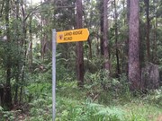
If you reach the Clay Pot Walking Trail sign you have gone too far and will need to turn around and take the track before it (Sand Ridge Trail - no sign). Easy walk, beautiful views. Getting down to the rock pool and cliff edge is a bit more difficult/challenging. Got spot. :)

Kayla on 5 Jul, 2020

Beautiful spot. Walk time said 2-3 hours, hubby and I did it in 1hr 30mins. Not well signed at all. There is a post on the track near where you need to go but no sign and no pink flags to show the way. Not much to see on the walk down to the falls but falls make up for it.

NikkiW74 on 21 Jun, 2020

Thoroughly enjoyed this walk with my husband and 7 year old son. Definitely wouldn't have found the place without the instructions on this site, so thanks for that!
We ended up following the road all the way down to Sand Ridge Road on the left, although on the way back we took the little trail that others have mentioned having pink ribbons, although we only saw one ribbon and that was on the way back. Obviously the path less taken! Enjoyed it though. Got the heart going on the way up the steep section, but once it levelled out and we'd made it back to the road, the rest of the walk up to the car was easy.
The walk down the creek was fun. Rocks were a bit slippery and I did land on my butt at one point (I've got to stop doing that! haha, wasn't the first time a slippery rock has gotten the better of me). The rock pools were stunning, although the water was too cold to swim! There's a good amount of water flowing down at the moment, so a lovely time to visit.
We managed the walk fairly easily, even with the uphill parts, but then we do go walking most weekends at this time of year and I'd say our fitness level is moderate / active. My 7 year old set a great pace uphill (husband and I struggle to keep up with him sometimes!), although I think if we'd taken our 9 y/o as well she might've struggled on the uphills a bit (she's not quite as enthusiastic a bushwalker as her brother). So it was a good walk to do while she's away for the weekend (haha).

Sarah on 18 May, 2019

Easy to find with the helpful comments left here from other walkers. 45mins down and an hour back up due to the incline, but wasn’t to hard with a moderate pace. Pools were beautiful and running, although quite cold once you were in! Great hidden gem without the crowds, hopefully it stays hidden for a while longer.

Nic1385 on 7 Apr, 2019

Surprisingly good and nice swimming holes!!

Mackamcb on 23 Jun, 2018

Nice walk. Saw a kookaburra, heard whipbirds and possibly cockatoos. Walked along the creek until the big drop- very slippery and challenging at parts but was gorgeous. Would have been nice to take a swim if it was hot. Wouldn’t take kids to the end as it’s a big drop. Easy first half- coming back got the heart rate up.

Mellie on 29 Apr, 2018

Clive must be VERY fit. A bit more than a gentle incline, depends what you compare it with, but everyone who we spoke to all said the same thing, medium fitness required. Magnificent, cool, refreshing swim down below, worth the walk.

Ben on 2 Apr, 2018

Easy walk with my 9 yr old. 45 mins there and 50 mins back and some time to swim. Walk is very easy to find - first left is a road not a track and there is only one. You cannot miss the bridge or the path to the pools - very simple walking along the river bed. Just remember left along sand ridge road and right over the bridge (although there is nowhere else to go).

Well worth the exercise as its just a gentle stroll and not steep just a gentle incline. Road\track looks well maintained by national parks.

clive on 11 Jan, 2018

Fantastic Falls

samkramer on 29 Jun, 2017

Awesome walk with incredible water holes and waterfall at the end that you can stand at the top of.
Seems like a lot of people have trouble finding it and the way so I uploaded GPS coordinates to my website as I can't link to maps on here properly
http://coastalventures.com.au/boat-hire-resources/hell-hole-falls-instructions/
If you haven't already, I highly recommend downloading "Maps.ME" for your phone. It's offline maps and you can save GPS coordinates to it before you head out. It is also slightly different to Google Maps in that it is a community based map that you can see other hikes etc that aren't so well known.

Mike on 1 May, 2017

Definately worth going to. Water was flowing, clear and geat to swim in

Ruskey on 25 Apr, 2017

Such an incredible place. Volcanic rocks, powerful waterfalls, crystal pools to bathe in with stunning views. Go on a sunny day if you can!

Casper on 28 Mar, 2017

Bit of a hike getting up there. Probably should have read more of the comments. The GPS tells you to keep on down the road, but the road is cut off. At your first fork, take a left. Then once past the "road closed" sign, hang a right and follow the creek until you get there. Great place.

Danny Z. on 28 Jan, 2017

Easy walk down the fire trail. Poorly signed, would not have found it if not for the comments on aussiebushwalking.com
Really beautiful cascading waterfalls and swimming holes. Would definitely go again.
The walk back was harder, mostly uphill and very hot. Go early!!

flashsam on 17 Jan, 2017

No FWD required to get to the track. The sign for the track is posted off the road. you will probably see other cars parked before you see the sign. The walk is easy and even and it's a wide track. It can be confusing when you come to the Crossroads, take the track to the left all the way to the end until you come to a crumbling in desperate need of repair walking bridge - it has giant holes in it so use extreme caution when crossing it. If there's no water in the creek I'd cross there to save yourself a broken ankle. Immediately after the broken head right the track continues for another 200m or so until you reach the Holes. the track is narrow but well worn and you should be able to find the holes with no trouble. Just a side note - if you decide to head right rather than left - this track is much longer and seems to take forever to get to the end - the rock pools at the end aren't that impressive. They are nice - but there are lots of lovely rock pools in the region and this one isn't the best. They are also not 'the' Hells Hole.

BeckNWood on 3 Jan, 2017

I walked this today after mount warning and I must say I was very disappointed. The water holes were stagnant and covered in insects and there was no one there swimming or anything.

And the walk back to the car is hard after walking down hill and not even having a swim. I definitely wouldn't go again.

Juiced Pixels on 30 Nov, 2016

Very easy walk, have a good look at maps and save locations before you head out reception is on and off. I got confused at the first fork as there is also a walking trail leading off the to the left with coloured tape, lucky I had reception and found a short youtube clip of this walk. The whole walk down is fire trail until you get to the old bridge where you follow the creek line down. The pools are amazing little swimming holes and I had the place to myself, if you look around the pebbles you might find pretty chunks of black obsidian (volcanic glass). Really loved this walk :)

sarahsdrunk on 11 Nov, 2016

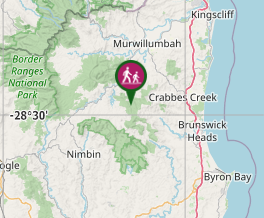
Where

Click here to load this map.

Nearby Walks

Done this walk?

This walk has been ticked 59 times

Aussie Bushwalking can keep track of your bushwalks.

Login/signup to tick this walk off.

Tick walks to keep track of where you've been. You must Login to tick walks. Accounts are 100% free so sign up if you don't have one.