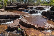
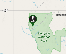
A 40-50km circuit in Litchfield National Park in the Northern Territory: the length depends on which access track is used to access the circuit. The walk goes through an arid and often burnt landscape, but is punctuated by beautiful waterholes and creeks. There's a pretty good chance you'll have one of the three camping sites to yourself.
Getting there
About 120km (2 hours) south-east from Darwin via Batchelor on a fully-sealed road or through Berry Springs via the partly unsealed Cox Peninsula Road (dry season only; 2WD accessible).
Maps
Australia’s Northern Territory Litchfield National Park – Edition 7 (topographical map). Can be hard to find.
Route/Trail notes
A circular walk around the Tabletop plateau, accessed via three "link tracks" (Wangi Creek, Greenant Creek, Florence Falls). Can be walked in either direction and there are three official camp sites. Can be done in two days - 3-4 is the recommended duration, which also means you can walk in the morning and rest in the afternoon when it's warmed. Navigating is hard as there are few obvious features to follow, but the entire track is marked by blue markers at regular intervals.
Permits/Costs
No permit in the Dry season (May-September). A permit is required in the Wet season and if the track is closed (eg. due to bushfires).
Other References
https://hikingtheworld.blog/2018/07/15/tabletop-track-litchfield-national-park/ - detailed route notes and photos
GPS Tracks
- No GPS available for this walk yet.


 42
42 3
3
Comments
Nobody has commented on this walk yet. If you've done it then tick it off and add a comment.