Mount Ontake is an active volcano and one of Japan's most holy mountains. Mount Ontake is also one of Japan's 20 peaks that stand at over 3,000m. It has beautiful volcanic lakes and alpine vistas.
This hike is very easy. There is no scrambling, it is just long.
Also make sure that you pay attention to warnings. As Mount Ontake is an active volcano, it can erupt at anytime. Make sure you are prepared in the case of an eruption. In 2014 a number of hikers died on the trail during an eruption.
Also make note that the ropeway closes at 4:30pm.
Getting there
To begin the hike, you can either take the bus to the Ontake ropeway or you can drive to the carpark at Ontake ropeway. Driving is probably more convienient.
Maps
They have maps on the mountain.
Route/Trail notes
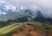
From the ropeway, walk up to the junction and follow the sign that says 山頂, there is no English. This will take you along a nice mulch path. Continue straight along this path where you will start heading uphill. In this section it has steps. This section doesn't offer many views, but has lots of interesting alpine vegetation. Once you clear this section, the vegetation will thin out and the track will be more exposed offering views of the surrounding luscious mountains.
Continue following signs for 山頂. Along the way you will pass numerous mountain huts and religious sites.
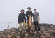
Once you reach another junction towards the top of the mountain, first take the path upwards to the true summit, Kengamine. Look at the maps and follow signs for 山頂. The true summit is a shrine with concrete stairs.
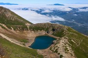
From the true summit, go back down to the junction and lake a turn towards ni no ike lake and then continue following signs for san no ike lake. This will take you to the other side of Ontake and provide beautiful views of the volcanic lakes.
Retrace your steps back to the junction and then head back down the mountain, the same way you came.
Permits/Costs
Ropeway is about 2,500 yen
GPS Tracks
- No GPS available for this walk yet.




 10
10 6
6
Comments