Shepherds Peak

Expedition National Park

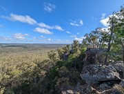
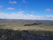
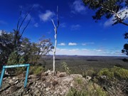
This walk begins at Starkvale camping area and goes through open woodland with a well-defined trail. The first part of the walk is easy with a slight incline which changes once you get to the start of the climb up Shepherds Peak. Parts of this climb are very steep although there are some steps on the steeper parts but a fair level of fitness is required to get to the top. Care should be taken once at the top as the edges of the cliffs are unfenced. But the panoramic view of the gorge is breathtaking, especially early in the morning.

Getting there

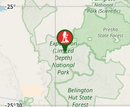
Park turn off is 18km north of Taroom. From there it's 4WD only.

Maps

Which maps cover the area?

Route/Trail notes

A detailed description of the walk!

Permits/Costs

Do you need any permits? What's the cost?

Other References

How can I find more info? Any guide books?

GPS Tracks

  • No GPS available for this walk yet.

Comments

This one is actually more interesting than the Gorge one as that is fairly flat, some steeper section here with nice views of the length of Gorge

J on 10 Jun, 2017

We took this walk at 5.30am which was when the birds were at their best in the open woodland section of the walk. Birdsong from friar birds, currawongs, golden whistlers, rufous fantails and budgies was almost deafening in one section of the forest. As we climbed Shepherd's Peak we wondered if it might not have been better to have done the walk the day before as it was the most strenuous of the four walks in the area. The view from the top though was amazing. You can see most of the gorge and the surrounding mountain range.

Garry Williamson on 31 Mar, 2013

Where

Click here to load this map.

Nearby Walks

Done this walk?

This walk has been ticked 4 times

Aussie Bushwalking can keep track of your bushwalks.

Login/signup to tick this walk off.

Tick walks to keep track of where you've been. You must Login to tick walks. Accounts are 100% free so sign up if you don't have one.