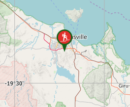
Mount Stuart

North Queensland

15km return walk from the steep roads ahead sign. 7.5km of continual uphill then 7.5 back down. There are no tracks available to the public so you need to walk up the narrow road.

Getting there

Turn off Stuart Drive into Mount Stuart Road. There is a clearing near a sign saying 7.5km of winding road ahead. If you walk right from the bottom of the road near the Highway the walk is 18km return.

Maps

Any Townsville Map

Route/Trail notes

The walk is all on the road and takes you up and over the foothills of Mount Stuart right up to the towers. At the top the is a small track called the Loop Trail.

Permits/Costs

Nil

Other References

Information Centre

GPS Tracks

  • No GPS available for this walk yet.

Comments

Started from the bottom of Mt Stuart. Made the top - 9 km just on 2 hours. Then back to the bottom. Feel the burn..

@Nomad on 1 May, 2016

Hard work with little to see until the top unless you are lucky enough to have MTB riders tearing down the side trails.
As mentioned its hot even in the dry season and fairly exposed so bring water and sun protection.

NerdTrails on 16 Sep, 2014

Very hot walk even in winter. Not a great deal to see until you reach the top but it is an achievement to complete.

jen on 14 Aug, 2011

Where

Click here to load this map.

Nearby Walks

Done this walk?

This walk has been ticked 10 times

Aussie Bushwalking can keep track of your bushwalks.

Login/signup to tick this walk off.

Tick walks to keep track of where you've been. You must Login to tick walks. Accounts are 100% free so sign up if you don't have one.