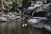
Cedar Creek - Black Creek

South East Queensland

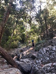
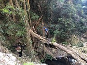
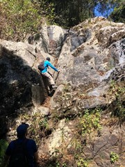
A nice loop along the creeks, falls and pools. Some hard steps requiring a little bit of easy climbing, sometimes impressive, especially when going down.

662m
Maximum Elevation
1246m
Total Climb

Getting there

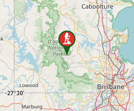
30 km from Brisbane, drive to the end of Cedar Creek road.

Route/Trail notes

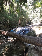
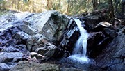
Walk, rock hopping, along the creek, up to Cedar Falls (a sign full of graffiti indicate that you reach them). Climb the falls, and few meters after a creek will join Cedar creek from the left (From Mt Glorious). I believe it is Black Creek. Climb this creek as much as you can. At the top, the aim is to find Lindsay Road. A compass and or a GPS would facilitate this. (The creek pass few meters from the road but it is not obvious to find, look for habitations on your left.

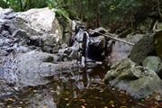
Follow this road to Mt Glorious road (right) then to Maiala Picnic ground. Follow Greene Falls track. At the end of the track, you are at the top of Love Creek. Climb down the creek (few impressive falls, do not hesitate to bypass them through the forest or take an abseiling rope.) Cedar Creek joins Love Creek via a small waterfall on the left. From here the terrain becomes a lot flatter and is almost a highway in comparison to the slow trip down Love Creek.

Enjoy the pools.

Note that rock hopping, climbing up and down takes a lot of time and that the hiking speed is not comparable to regular walking speed. I did this walk with my partner in 6 hours with a 20 min break for lunch, another 15 min break at maiala restaurant (for an iced chocolate) and a 15 min break for a swim. I would advise to start this hike early to have some more time to enjoy the pools, the falls and this relaxing environment. We didn't had a rope and it was fine, but for peaople who like abseiling, it might be considered.

Permits/Costs

We saw several marks of likely Bush camps along Black Creek. See with National park regulation for costs.

Comments

Went up cedar, down black. About 10km round trip over 5 hours, 500m up and down. Going up cedar is relatively straight forward, just have to scramble up the banks for some of the more menacing falls. Going down black was a bit more sketchy - there was a section about halfway down where is stopped running but eventually pick up again - up the top was plenty of lantana and lawyer vine.

Definitely not a stroll in the park, but an absolute blast regardless. Other than the rockpools and maiala I didn't see a soul.

Martin Welsh on 21 Aug, 2021

We went up Cedar Creek to Greenes Falls, then around to Lindsay Rd, which looks like it has been extended and crosses a branch of Black Creek, so we took that branch to get on to Black Creek. No bush bashing involved. The only time Black Creek was impassable (in the flat section soon after we first walked into Black Creek, there was a clear path slashed on the South-East bank which bypasses all the lantana. I would definitely advise people to have rock climbing skills for Black Creek, and staying in the creek. Cedar Creek is tamer and good scrambling skills should suffice. We completed the walk in 5 hours which included a leisurely lunch in Maiala Picnic grounds. The distance is definitely not 18km and my guess is more like 10km. And Google Maps is way out with its creeks. We used pocketEarth which was great.

Gazza on 30 Jan, 2021

Lots of vertical rock scrambling.

EchidnaScout on 19 Sep, 2020

Done in 5 hours.

Marta Brozynska on 2 May, 2020

I did only half of the described walk (instead of up Black and down Cedar I went up Cedar and came back via Love Creek)... love this area and enjoyed the walk and swimming holes greatly.
I just wanted to comment on some possible confusion here. Looking at the google maps this seems largely inaccurate. I am using an app called Navigator Pro and have to say I was amazed by its accuracy and overall smooth experience. Anyway back to the hike.
The 2nd creek in original description (down leg of the trip, 'starting' at Greenes Falls ) is Cedar Creek, not Love Creek.
Going up from the Cedar Creek swimming hole (giant rocky stairs going up next to the falls) on the left is Black Creek and after left turn bend you pass large house (seems private resort) partly hiding in the trees on the right. Follow further to the junction of Cedar Creek (left looking upstream) and Love Creek (right with small waterfall). The CC falls, the resort are about 1/3 and 2/3 of the distance to this junction. For Love Falls follow Love Creek, not far from the junction.
On the top both Black Creek and Cedar Creek track lead to Browns Road (from opposite sides).
The track following the Love Creek down starts from the very end of Alex Road, it continues roughly in the direction of the road, for the first 150m it is barely visible but follows the gentle ridge until it gets to the junction of 2 small streams.

igorh on 13 Jan, 2019

Considering how close this is to Brisbane, anyone who loves a hike should check this out.

My party took the route as described, turning left immediately after the main falls with the graffiti etc. There is an obvious slab with some writing on the rocks indicating the way to the Nudist section or something? :) The route following this creek is fairly overgrown but there are some fantastic little nook's along the way and several cascades to negotiate - one which is about 10-15 metres tall - great fun though would be rather difficult to climb down this way I imagine - which is why I think this is the route you should take going up.

The trail can be a little tricky to follow once the rocky creek starts to disappear after climbing and rock hopping for 2 hours or so. Once the creek levels out and becomes sandy rather than rocky and enters a small forested area (the rocky part of the creek is fairly open in most places), you need to keep to the left of the stream. Thankfully, some kind person has mowed a track through the brush and lantana and soon enough you reach Lindsay Road which can be follow up to Mount Glorious Road.

This is a good spot for an intermission at the cafe before continuing onto Maiala Picnic Ground and Greene Falls which you then climb down. It is fairly sheer but not overly difficult. From here, it is a great adventure climbing down and rock hopping repeated sets of small cascades (seemed like there was about 7-8 at least) while being surrounded with beautiful forest. As some have noted, it pays to be careful and a little bush bashing may be required, it is all in good fun though.

The way back down Cedar Creek is much easier to navigate as you are following the creek all the way until it joins up again where you left off after the main Cedar Creek falls where everyone jumps off the rocks. All in all, one of most picturesque walks I've done close to Brisbane and well worth the efforts. It is certainly a full day trip (6 hours at least) unless you were to start super early. Be sure to take your togs as there are many swimming holes on the way back down Cedar Creek in particular and the fresh water is divine. Best avoided after heavy rain or any kind of rain as if the creek was swollen you may end up swimming rather than hopping.

In summary: Too close to Brisbane to ignore if you are keen for an adventure, beautiful scenery, does pose a reasonable challenge with some of the rock scrambling on the falls and is a great workout.

Matty Vee on Sep, 2018

Did this walk again today and have uploaded a gpx file of the route. It is definitely way longer than the original poster's 8 km. I logged it at 18 this time, which I think is pretty accurate based on time taken, difficulty etc. I thoroughly recommend the walk for those wanting a challenging hike that involves a lot of climbing up and down waterfalls etc. Still of the view that going up Cedar and down Love i the way to go. And yes, the creek is definitely Love creek, not Black creek.

jamiehay51260 on 24 Jun, 2018

I did this walk yesterday, in the reverse direction. I strongly recommend this as the better route for three reasons. First, in terms of navigating the steep, scrabbly footpads that go round the sides of the steeper waterfalls, it is much preferable to be going up than down, in my opinion. Far safer and easier to spot them. Second, it means that you are moving towards all the wonderful scenery of Cedar Creek rather than walking away from it. Third, the ascent/descent of what is referred to as Black Creek but which is marked on maps as Love Creek, is no where near as nice as Cedar creek. Again, a personal choice, but I would not like this creek to be the first thing I navigate, since for a lot of the way it is overgrown. In places you have to scramble beneath lantana etc as you stay in the creek bed. Also, from others' comments here, it sounds as if it is much easier to find where to get into Black/Love Creek at Mt Glorious than it is find where to get out.
So, I walked up Cedar Creek, which really is a lovely, but challenging hike involving a lot of climbing up steep waterfall surfaces or precarious neighbouring footpads. I came out at Maiala picnic grounds, had lunch at the cafe at Mount Glorious and then thought I would be bale to wasily descend following the GPX track provided on this site. Unfortunately, it is wildly inaacurate in regards as to where to enter/exit Black/Love Creek. After an hour of fruitless searching and asking locals I finally got a bit of internet on my phone and was able to read the description saying you emerge on Lindsay Road. Down I went and just as the road veers sharp right there is a track going left. I followed this a short way until i saw where the creek crosses the path. From here it was a straightforward, if sometimes unpleasant descent of the creek back to my car at Cedar Creek. I thoroughly recommend the walk but it is not easy. I also logged the distance at 12 kms, not the 8 mentioned on the original track description.

jamiehay51260 on 2 Jun, 2018

My husband and I hiked this one and it’s defiantly a challenge. We made it to the end of black creek, but couldn’t get through the lantana. Ended up turning back and going back the way we came. Made it to the old
Pumping shed, then it was really dense.

Beautiful walk. Lots of rock scrambling/climbing. Leave with plenty of time as it’s lovley not to rush this one. Started to rain on the way back, rocks become very slippery and slows you down.

Emmalea on 26 May, 2018

Absolutely fantastic walk! Beautiful scenery, plenty of swimming holes and waterfall galore.
A few notes for people thinking of attempting this walk:
-the rock scrambling is easy enough, just like Northbrook Gorge only a bit more vertical, and nothing nearly as challenging as say Mt Barney. Only one particularly hairy spot, but a rope is tied to a tree so it's easy as. If you've done indoor rock climbing before you'll be fine.
-when you're approaching the top of Black Creek (you'll know it, lots of lantana starts to become apparent on the higher slopes) keep an eye out on the right for a cleared path through lantana that takes you past the local Fire Brigade shed and up to Lindsay Rd.
-research these three plants: Lawyer vine/wait-a-while, stinging nettle and stinging tree. Very nasty, and very abundant at times. Learn and avoid.

Took myself and a mate about 6hrs, including about 3-4 swimming breaks and a couple of food breaks along the way, as well as getting excited and trying to exit Black Creek too early, only to find ourselves swamped in lantana and native raspberry.

One of the best and most stimulating walks I've done on Mt Glorious

Muzbags on 6 Jan, 2018

I did this with two friends. There has been rain the previous few days and blavks creek was very much running. It was also extremely overgrown, and my friends and I were ripped up pretty badly by the vegetation.

There were parts of this hike that were more rock climbing than scrambling.

It was beautiful, but I would advise that this should only be attempted by someone wut at least basic rock climbing skills, That you should wear long sleeves and pants, and carry a rope and a machete. The way we did it was very stressful.

sk on 30 Dec, 2017

Very tough hike, but very amazing being in the middle of incredible rainforest along side waterfall after waterfall. Took me about 5hrs in total. I'm pretty sure I got lost coming up to Mt Glorious, should have stayed on the creek. Got badly stuck in a maze of lantana which was not fun, ended up bashing straight through it. Popped out on someone's property! Found my way to Greens Falls. Took a while to get down the creek from there (so many waterfalls to climb down + it was getting dark!). If I was doing this again, I'd take more navigation gear, a machete and wear long sleeved pants and shirt lol. Incredibly rewarding! But yeah, I'd say this is for EXPERIENCED bushwalkers only.

gravitys_grin on 10 Aug, 2017

Very beautiful walk. Took us about 5:30 hours. When we reached the little pumping shed at the end of black creek we kept to the left of the creek and after some bush slashing we ended up on a drive way. It was private property but we did not disturb anyone and got onto the Mt Glorious Rd after a couple of meters. The way downhill was nice as well but half way down it started to rain and the rocks became very slippery so be careful. This walk is only for experienced bush-walkers who are confident in rock scrambling/hopping.

Rayk&Christin on 20 Aug, 2016

Lovely shady environment for a walk on a hot day. Black Creek was only barely running but I had a nice dip in the pool at the base of Cedar Ck falls before heading up Black Creek and again in Cedar Creek after rejoining it after Love Creek. The trip up Black creek got very overgrown to the point I had to retreat and try a different route. No doubt conditions will change on a regular basis here but I found a relatively clear path to the right of this scunge. I tried to leave creek at a pumphouse but again was forced back due to mass growth of lantana. Pushed on about 200metres and after a junction with another creek before finding a reasonably clear path up towards a house (not visible from creek) and joining the road. I did the western window loop after reaching Mt Glorious Rd which added around 1.6km to circuit but was a nice easy, well shaded addition . Saw 4 common tree snakes of varying sizes, heaps of lizards and bird life during this walk. In the pool at the base of Cedar Ck falls I saw a turtle and eel. Heading down to Greenes Fall I came across a couple of a Red-necked Pademelons but they were too quick for me to snap a photo..

Grumps on 14 Feb, 2014

Where

Click here to load this map.

Nearby Walks

Done this walk?

This walk has been ticked 29 times

Aussie Bushwalking can keep track of your bushwalks.

Login/signup to tick this walk off.

Tick walks to keep track of where you've been. You must Login to tick walks. Accounts are 100% free so sign up if you don't have one.