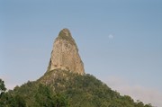
Coonowrin Circut (almost)

Glass House Mountains National Park

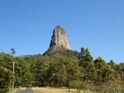
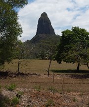
This track ALMOST makes it around the entire Coonowrin Circut, infact it is only a matter of 385mts that is blocked off by a gate and heaps of Private Property signs.

Getting there

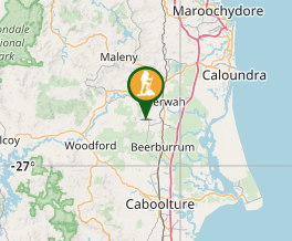
From the Glass House Mountains Township drive through the town. Turn right then the next left. Park at the end of Murphy's Road and walk the fire trail to your right.

Maps

Which maps cover the area?

Route/Trail notes

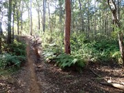
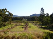
Pass the locked vehical gate and continue. You will pass at the back of some properties. Eventually you will find a path to the left. Take the next left after this aswell. Once again you will pass at the back of more properties. From here you will have nice views of Beerwah. There is no such path, just mowed grass near the fence line. The trail is up and down small hills.

Once you are nearly back to the other side of the mountain you will run into the horrid Private Property signs. We could not find a path to follow on the National Park side of the fence so as to not risk trespassing we turned around. In hindsight we would ask the people who live opposite the track on the left if we could pass through their land.

The path early on is an easily defined fire trail. Once you get to the back of the properties it is just a case of following the fence line.

Permits/Costs

Nil (Unless you choose to trespass :)

Other References

None we could find. Just decided to head out and have a look.

Comments

Good views of Mt Beerwah on the west side of walk, when you get to the end where the "Private Property"signs are you can bush bash the last 100 metres(scrub is not that thick) & you can see a gate which is the corner gate of private land, then follow the fire trail from there back up to Murphy's road saves backtracking about 5 kms. The fence line at the end is very noticeable so you won't be trespassing on any ones land if you keep a lookout

Bribie 61 on 13 Sep, 2022

On a mission to climb most of Glass House Mountains but failed to find my way around here.....the private property signs and the fact that track has been closed since 1999 on Nat Park website made it unsure to go further.....

J on 24 Oct, 2013

We'd had quite a bit of rain so the track was quite wet. We even needed to take off our shoes to cross one small watercourse. There were a couple of trees down over the path too which we needed to climb through. The private property sign at the end is frustrating even when you are expecting it.

Ian and Sue on 2 Feb, 2013

Did this walk solo. Got to the private property signs and veered uphill to base of cliffline. I then scrub bashed my way around northern side and found a goat track on south west side of mountain. Track is very slippery and steep in places. Managed to complete entire circuit but did slide for about 10 metres at one point down a particularly slippery section.

Grumps on Jan, 2012

Decided to try and find a track around Coonowrin. Almost made the full circut aswell. Had a laugh when we had to turn around when we hit the Private Property signs.

jen on 8 Oct, 2011

Where

Click here to load this map.

Nearby Walks

Done this walk?

This walk has been ticked 11 times

Aussie Bushwalking can keep track of your bushwalks.

Login/signup to tick this walk off.

Tick walks to keep track of where you've been. You must Login to tick walks. Accounts are 100% free so sign up if you don't have one.