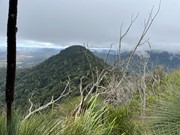
A variation on the usual Mt Mitchell walk, for those who want to "bag" another peak
Getting there
How do you get to the start of the walk?
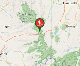
Start at the Cunningham's Gap Carpark, crossing the road to the Mt Mitchell track.
Maps
Which maps cover the area?
QTopo, All Trails
Route/Trail notes
A detailed description of the walk!
Follow the graded Mt Mitchell track for about 3km. The track turns from a westerly direction to a southerly direction, contouring around the ridge leading up to the West Peak summit. Keep an eye out on your left for a suitable point to head up the ridge heading east (you may notice a foot pad). Head up, scrambling up a few small cliffs (no significant exposure), until you reach the Mt Mitchell West Peak summit (no views, unfortunately). It can be difficult walking because of blackberry and loose rocks. From the summit continue following the ridge east (there is a slightly more obvious footpad), gradually descending into the East West saddle. Then turn right and descend down in a south-southeasterly direction to return to the main track and proceed to the Mt Mitchell East Peak summit. I recommend returning via the main track (it's a lot easier)
Permits/Costs
Do you need any permits? What's the cost?
No costs.
Other References
How can I find more info? Any guide books?
No other references that I can find. I strongly suggest taking a GPS app like All Trails, in order to find the best place to return to the main track.
GPS Tracks
- No GPS available for this walk yet.


 9.5
9.5 3.5
3.5
Comments
Nobody has commented on this walk yet. If you've done it then tick it off and add a comment.