Piccabeen Circuit

Mapleton National Park

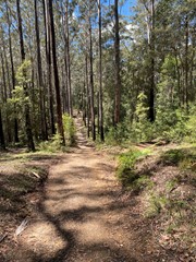
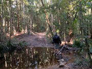
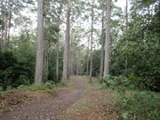
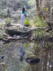
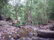
Piccabeen Circuit provides a pleasant walk through piccabeen groves, tall blackbutt forest and rainforest communities and across various creeks.

Picnic Facilities
BBQ
Toilets
No Dogs Permitted
Horses Permitted
Rainforest
492m
Maximum Elevation
36m
Total Climb

Getting there:

Head for Mapleton and turn into Obi Obi Road and then turn right (signposted) into Delicia Road, before turning right after 500m into Mapleton Forest Road. Follow this to the Mapleton National Park Day use Area, the last part of which is well maintained gravel road suitable for any sort of vehicle.  Park away from the road to avoid a car covered in dust when you get back. Beyond the Day Use Area the road (Mapleton Forest Rd) deteriorates.  It is a nice forest drive emerging at either Cedar Creek or Cooloolabin Dam but the warning signs "high clearance 4WD recommended" should be taken seriously.

Maps:

Mapleton National Park

Route/Trail notes:

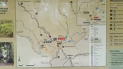
This is one of the best signposted tracks (no. 3) I have come across in a very long time. At each junction, there is are clear signs as to which way to go as well as a map board to tell you where you are. Well done National Parks.

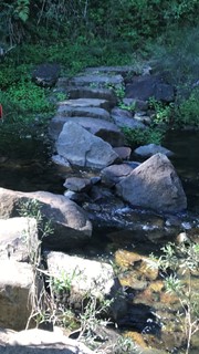
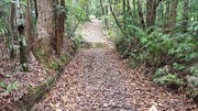
So head out from behind the car park and turn left or right. If you head left, the track follows the road down to the Leafy Lane access, before heading out along various wide fire breaks. The first 2.5km is pretty flat, but from there on, it switchbacks and includes four creek crossings, which may be difficult to cross after heavy rain.

Permits/Costs:

None.

Other References

This is a 'shared' track with horse riders, so take care. Mountain Bike and Motor Bike riders are not allowed on this track, as their designated tracks are further north, but I saw tyre tracks, so be aware.

Comments

great walk!

Wrenchie on 14 Apr, 2024

Really nice walk. Flat sections and then rises and falls the whole circuit. Passes through some really nice creek sections, with a bit of rainforest.

Wide track (car sized) and evidence of horses but didn't get to see any.

Jensen Family on 26 Jun, 2022

Very nice walk . About 8km , 2 hrs, some up and down but not to bad. Creeks easy to cross at the moment

JW on 2 Oct, 2021

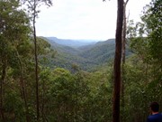
Very nice walk, views from Ubajee camp lookout were good

Bribie 61 on 18 Apr, 2021

A very pleasant walk. This walk is a circuit with several crossings of the Gheerulla creek meaning also what goes down must come up! Not too steep but still to be taken into consideration. Plenty of tall timber and lots of bird life if you take the time and quietly observe.

Bootson on 16 Mar, 2021

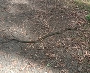
Did Piccabeen Cct today. Enjoyed the walk. Interesting that it's graded medium; I've done other medium walks that were a fair bit harder than this. A few steep-ish sections but OK even for average fitness, just stop for a breather when necessary. The track is wide and easy to follow with very clear directions. Creek crossings were no issue today but could be after rain. I saw a snake stretched across the track - coastal carpet python I think - see photo.

Jim Craigen on 3 Sep, 2020

did this one today- clocked it at 7klm...easy to find and all the info here is spot on...the walk itself is mainly on wide logging trail and not overly pretty say compared to a few others in the area...no views, took me 1hr 35 min -- a few hills but not hard at all....ok for a one off..

Greg Brady on 3 Aug, 2020

This was a very easy to follow walk through the forest with the added bonus of a short detour to the lookout from the Ubajee Walkers Camp. We did 9km in total and took just over 2 hours with a nice break at the lookout.

Bobbe on 8 Mar, 2020

We hadn’t planned to do this walk today but the ghureela track is closed. It’s a really pretty walk but it’s pretty hilly. Gives a good workout. It is very well signed. We were confused at first though because we stopped at the wrong car park. We missed the first part that ran along beside the road and started at the wider trail which went straight ahead.

Ian and Sue on 5 Oct, 2019

Nice short walk with creek crossings

Salem13 on 13 Jul, 2019

Relatively quiet part of the park even on a Saturday. Easy track to follow , may after heavy rain be challenging to cross a creek or two but would say most of the time this should not pose an issue.

J on 16 Feb, 2019

Cooler weather than usual for January, has allowed me to get out and around early this year. Having never visited this part of Mapleton National Park, I was surprised by how many walks there were. Managed to cover three in the day, and given it is holiday time, I did not meet one single other person: no walkers, horses, mountain bikes or motor bikes!

F.A.B. on 10 Jan, 2019

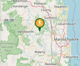
Where

Click here to load this map.

Nearby Walks

Done this walk?

This walk has been ticked 39 times

Aussie Bushwalking can keep track of your bushwalks.

Login/signup to tick this walk off.

Tick walks to keep track of where you've been. You must Login to tick walks. Accounts are 100% free so sign up if you don't have one.