- Spring Mt Caldera (Thornbill Drv trail head) (White Rock - Spring Mountain Conservation Estate)
- Spring Mountain (Angelica Ave trailhead) (White Rock - Spring Mountain Conservation Estate)
- Frilled Neck Lizard Circuit (White Rock - Spring Mountain Conservation Estate)
- Balancing Rock (Ben Nevis Park trailhead) (White Rock - Spring Mountain Conservation Estate)
- Ironbark Track (White Rock - Spring Mountain Conservation Estate)
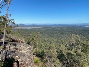
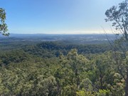
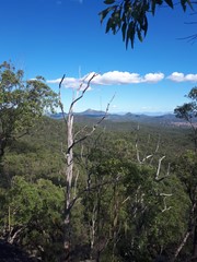
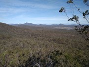
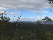
Spring Mountain from Thornbill Drive, Greenbank. Walk is a bit of a hard slog but the views from the different points on the trek are really spectacular.
Getting there
How do you get to the start of the walk?
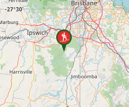
Set your sat nav to Thornbill Drive, Greenbank. Follow it to the end and you will see a little area to park near a gate. You should see a building (water tower) up ahead and a sign that says Spring Mountain Forest Park
Maps
Which maps cover the area?
I highly recommend downloading an app called Pocket Earth (or similar) and using this for this trek. Some navigation skills would be good for this walk and using this map on the app or printing something off would be good to make sure you don't take the wrong trail.
Route/Trail notes
Go through the gate where you park and head up the drive way and follow the trail off to the right halfway up.
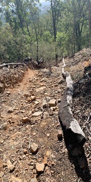
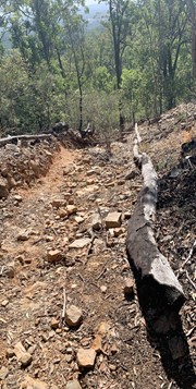
The trail to start off on is 'Water Tower Track'. You will come to a junction that turns right to 'Yahoo' or straight 'Ring Road' keep going along 'Ring Road'. You will eventually get to a Y junction. Take the left here. You will get to a track that heads up hill and has a lot of loose rocks. This is a hard slog so be careful as you walk up so you don't loose your footing. As you near the top you will notice some large rock formations.
Once you are at the top of the hill you will see a track heading downwards on the left. Take this to head to Spring Mountain.
*Option here is to follow around to the right a little and a track winds up to the top of the rock formation where there are some good views and you can rest here. Retrace you steps back down (take note here that if you turn right you will start heading back down through a gully which will lead back to your car - we did this on the way back). To head to Spring Mountain you need to head left and then take the steep downwards path (mentioned above).
The track down here is quick steep so be cautious. You will follow this trail and again head back up until you get to a nice view of Springfield and the City on your right. Continue on further until you get to a clearing and another Y Junction. Take the right junction.
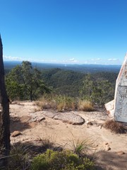
Continue on again - look out for a cool cave that we think looks like a pizza oven (on your left). Continue on this path until you see Spring Mountain. It looks like a red dirt path on the left and very steep. It is doable though! Once you head up you will need to start climbing up rocks It is a hard slog but it is worth it once you make it to the top. There are 360 degree views which are spectacular and this is the reward on this trek.
Head back down and take a look at another cool cave on the left as you head back down. Take super care coming down as it is very steep. But fun!
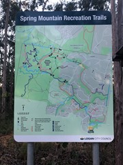
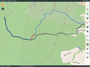
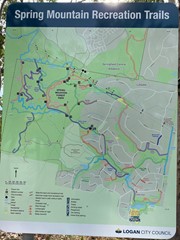
I have added a photo of the map which shows the options for the tracks you can take. Again I would highly recommend downloading a map or using a navigation app to help you on this trek as there is NO signage and some of the track is just gullies and I could see someone getting lost or going around in circles if not careful.
I would also recommend that if you are doing this in the wet to be super duper careful as I could see lichen on the rocks which would be slipperly when wet and also going down the steep hills would be slipperly. We had a few little falls (nothing serious) on the way down one of the gullies on the loose rocks.
Permits/Costs
Do you need any permits? What's the cost?
No permits are required.
Other References
How can I find more info? Any guide books?
Download a good navigation app like Pocket Earth and use it to help guide you on this walk.
GPS Tracks
Where






 Spring Mountain GPX Track (GPX)
 11
11 4
4
Comments