
Eagles Nest
Brooyar State Forest


Menu
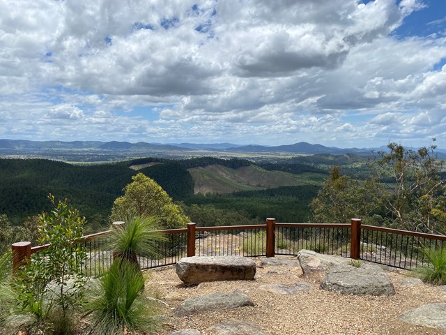

A short walk to a similar lookout to Point Pure, with its sandstone cliffs and views over hoop pine plantations and mature rainforest with emergent hoop pines.
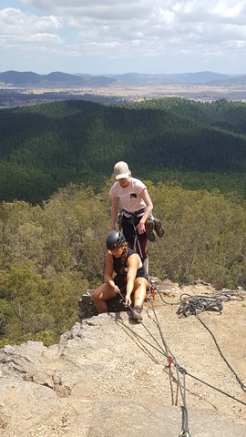
Also a good place for some rock climbing and abseiling, if you're into that, or just watch the fun.

Getting there:
The Brooyar State Forest map page from the link below shows three access points. From the south turning off the Gympie Woolooga Road onto Diggins Road that becomes Greendale Road and signposted left just beyond the Glastonbury Creek Camping Area.
From the north off the Wide Bay Highway onto Petersen Road or further along onto Reid Road, again signposted at the junctions.
All these roads are unsealed and can be driven by 2WD vehicles, but a 4WD is recommended. A small car park is located at the start of the lookout track.
Maps:
Route/Trail notes:
From the car park, the walk is a short track to a lookout platform.
A track also leads off from the left of the lookout to the bottom of the cliff. This is the access route for the climbing Crag. Please be respectful of the climbers and don't attempt to climb without the proper equipment and training.
Permits/Costs:
None.
Other References/Comments:
Further details on climbing and abseiling - Brooyar Climbing and Abseiling
Camping is available at Glastonbury Creek and can be booked from the Brooyar State Forest link above.
GPS Tracks
- No GPS available for this walk yet.
 100
100 15
15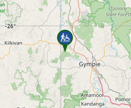
Comments