Mount Perry Summit Walk

Wide Bay Burnett

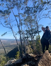
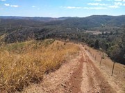
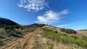
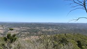
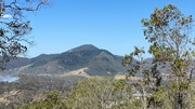
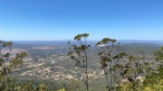
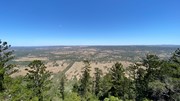
Mt Perry. The walk up to the tree line is the hardest part. About 1km , constantly going up, in the sun and warmth of the morning really takes it out of you. The track through the trees and up to the peak is quite a good one and anyone who enjoys a good bush walk should have no problem reaching the peak. Once there the views are fantastic.

Lookouts
No Dogs Permitted
No Camping Permitted

Getting there:

Travel to the town of Mt Perry and follow the signs to the parking area on Scrub Road.

Maps:

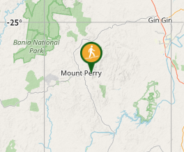
Find it in the North Burnett area

Route/Trail:

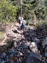
Trail begins with a 1km uphill walk before you hit the tree line. After that it is cool to walk through the trees and a pleasant walk to the peak. Just follow the marked 'alphabet' signs to the top.

Permits/Costs:

None.

Other References:

The Mount Perry Summit Walk was officially opened on 7th August 2021, as previously access was prohibited due to it crossing private land. A track was developed by the Mount Perry Community Development Board.

GPS Tracks

  • No GPS available for this walk yet.

Comments

Lovely walk. First section quite steep, then once you reach the tree line it becomes a more gradual climb. Beautiful views along the way. So much to see once you are in forest area.

Di on 24 Aug, 2024

I did this walk about 6 months ago when the new track with public access just opened. It's a beautiful scenic walk, challenging but not too much so. Be prepared for the first 1km, most of it straight uphill and no shade. Best time to walk this section is before 8:30am at this time of year as it's nice in the shade. One issue is that this section has not been maintained, and the grass is almost shoulder height for an adult with barely tracks through it.

Paula Wiseman on 6 Feb, 2022

The graded track made the walk comfortable. It is steep.

Michelle on 17 Oct, 2021

Lovey walk! Took an unfit group of us about 3 hours. The start is a very steep hill that we struggled with but once you get past that it’s quite a lovey forest type trail and not too difficult again until the very last part.
Definitely one anyone could do even if you have to talk it slow.
Do wish they had cleared just two small trees from the top so they view was more worth it.

Benitta on 28 Aug, 2021

Done. Was great day out and medium difficulty climbing.

Kelvin on 15 Aug, 2021

So I'm writing this well after the climb. Mostly because it wasnt a registered walk when I originally went up. Most days I like to start early however somedays I need to do school drop off first so Im going to guess that after the kids were dropped to school we made our way out to Mount Perry which is approx 70 minutes drive. So it was sun up and the first k of this walk is steeeeeep. It's straight up vertically fire trail. But after that first k the rest is wonderful. It's a great mix of different terrains. Dry bush, flat rocks and even rainforest with mossy trees. It's well marked and we never came across any incessant creatures like mozzies or flies so its really quite pleasnt. When you get to the last leg of W you keep going up. You'll come across a fork and both ways lead to the top. Right takes a steeper walk than the left and the view from the top is nice. Always be sun smart and take water. I dont recall my phone coverage being great up here but could be the area.

Valda on 10 Aug, 2021

We drove to Mt Perry township specifically for this walk only to find we couldn't actually find the start of the walk. No signage at all. We spent over an hour driving around trying to find the starting point, drove back into town to ask at the local store. The lovely lady there couldn't give us definite directions so she phoned someone she thought would know for sure. That person said it was too hard to find so we left very disappointed.

Lone Ranger on 27 Jan, 2018

I walked up with my husband, who pushed his bike up to ride it back down. He got out of control and fell off, which I kind of knew he would because it's so steep. I had some photos (of the view and shed, not of his fall!), but I can't find them, sorry.

Jen on 2016

Where

Click here to load this map.

Done this walk?

This walk has been ticked 9 times

Aussie Bushwalking can keep track of your bushwalks.

Login/signup to tick this walk off.

Tick walks to keep track of where you've been. You must Login to tick walks. Accounts are 100% free so sign up if you don't have one.